Elevation: 8,848.86 m (29,031.7 ft) snow-surface height
Rank: highest point on Earth above mean sea level
Approximate longitude: 86.925° E
Height of Mount Everest
China and Nepal jointly announced 8,848.86 metres in December 2020. This is the snow-surface elevation based on their modern survey work and is the clearest figure to use for general travel information.
Two related definitions help explain older numbers: snow-surface height includes the snow and ice covering the summit at the time and under the conventions of the survey. It is the jointly announced 8,848.86-metre figure used by both countries.
Rock height refers to the elevation of the solid rock beneath the summit snow. China's 2005 survey reported a rock height of 8,844.43 metres. It is not a competing location or a claim that the mountain suddenly lost several metres; it answers a different measurement question.
When comparing sources, check the year, vertical datum and whether the number describes snow or rock. Rounding also explains why 8,849 metres and 29,032 feet appear in general references.
The accepted 2020 snow elevation supersedes legacy website values such as 8,848.13 or 8,850 metres for ordinary factual use.
How to Measure Mount Everest
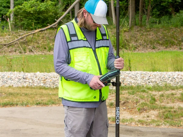
Mountain elevation is the vertical distance above an agreed mean-sea-level reference, not simply the length of a line dropped to the nearest valley.
Modern surveys combine summit observations with satellite positioning, gravity measurements, leveling and geoid models that connect the summit to a national or global height reference.
GNSS can locate the summit precisely in three dimensions, but converting an ellipsoidal satellite height into elevation above mean sea level requires a gravity-based geoid model. Snow depth must also be assessed when reporting rock height. The landscape itself is explained in
how Everest formed.
History of Measurement of Mount Everest
In the nineteenth century, the Great Trigonometrical Survey used long-distance angle observations and calculations to identify “Peak XV” as the world's highest known summit. Andrew Waugh announced a value of 29,002 feet in 1856.
The 8,848-metre figure widely used in the later twentieth century came from Survey of India work. China's 1975 survey reported 8,848.13 metres including snow, while its 2005 campaign reported 8,844.43 metres to the rock surface.
Other GPS-era surveys produced values near 8,850 metres. Their differences reflect instrumentation, snow assumptions and reference systems; the joint 2020 announcement now provides the shared official snow height.
The Changing Height of Mount Everest
The Indian and Eurasian plates continue to deform the Himalaya, while earthquakes can shift the crust and snow depth changes seasonally. A single simple growth rate should not be presented as the mountain's guaranteed yearly increase. See the regional relationships on the
Everest map.
Is Mount Everest the Highest Point on Earth?
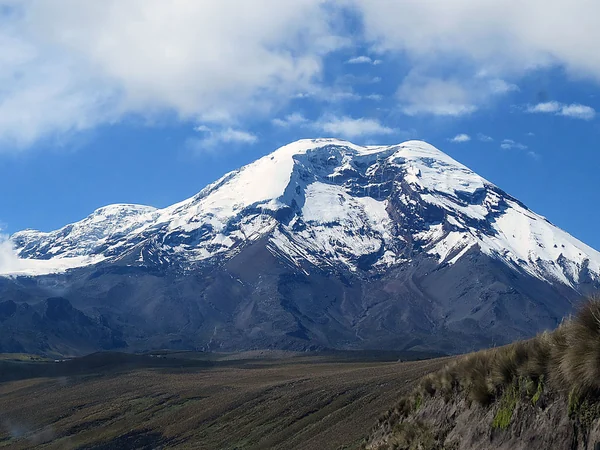
Yes—when “highest” means elevation above mean sea level. Different definitions produce different winners, which is why “highest” and “tallest” should not be used interchangeably.
Mauna Kea rises more than 10,000 metres from its submarine base but reaches about 4,207 metres above sea level. It is often called tallest from base to summit, not highest in elevation.
Denali has a large local rise from the surrounding land and is one of the world's most prominent mountains, but its summit elevation is 6,190 metres.
Chimborazo in Ecuador is farther from Earth's centre than Everest because Earth bulges at the equator. Its summit is nevertheless much lower above mean sea level. Each comparison is valid only when the measurement definition is stated.

 Ask a Question