Your China & Yunnan Travel Experts

 Ask a Question
Ancient Silk Road networks and modern Eurasian infrastructure sometimes cross the same broad geography, but they belong to different systems. The ancient routes were shifting chains of oasis, steppe, mountain and maritime connections. Modern links use railways, highways, ports, aviation, customs agreements and digital logistics. Comparing them can clarify change; treating one as the direct continuation of the other creates false history. The Silk Road history provides the necessary chronology.
|
Feature |
Ancient networks |
|
|
Modern connections |
Route form |
Multiple branches changed with water, security and political control. |
|
Fixed infrastructure connects many separate corridors and modes. |
Main transport |
Pack animals, carts, river craft and ships served regional stages. |
|
Rail, road, sea and air move passengers and freight at different scales. |
Typical exchange |
Textiles, horses, glass, metals, aromatics, beliefs and knowledge moved through relay trade. |
|
Manufactured goods, energy, food, services, data and travelers move through regulated systems. |
Travel time |
A complete interregional transfer could take months and usually involved many intermediaries. |
|
Some city pairs connect in hours or days, but borders and transfers still matter. |
Governance |
Empires, kingdoms, cities and merchant communities controlled different segments. |
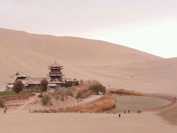
Exchange across Eurasia existed before the Han dynasty. From the late second century BCE, Han diplomacy and expansion through the Hexi Corridor increased court contact with established Central Asian societies. This was an important phase, not the invention of all east–west exchange.
Oasis towns around the Taklamakan supplied water, food, animals, storage and translation. Political control shifted, so merchants often traveled shorter sections and transferred goods rather than crossing the continent themselves.
During the Tang period, Chang'an, Dunhuang and Central Asian communities supported intense cultural and commercial exchange. Religious texts, artistic forms and technologies traveled with people, but they were translated and adapted locally.
Maritime routes grew alongside land routes and could carry larger cargoes. There was no single date when every Silk Road branch opened, peaked or closed.
The Silk Road map is most useful when read as a set of alternatives, not a modern itinerary line.
Archaeological context matters: an imported object proves contact, but not necessarily a direct journey by its maker or final owner.
Climate, river channels, war, taxation and market demand could redirect one corridor while another remained active.
The result was a resilient but uneven network shaped by local communities as much as by empires.
Modern travelers can trace this history through museums, caves, passes and oasis ruins, provided each stop is placed in its correct period.
A Ming fortress, a Han pass and a Tang cave may all appear on one tour, yet they should not be described as contemporary.
This chronological discipline turns a scenic route into a reliable account of how the networks changed.
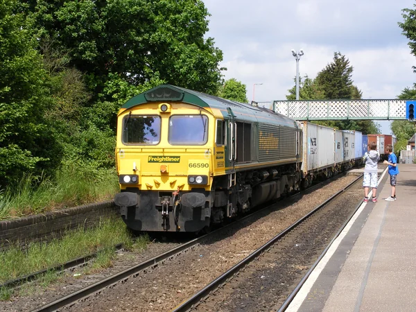
The contemporary Belt and Road Initiative was proposed in 2013 and includes cooperation in infrastructure, trade, finance and cultural exchange. It is explained separately in the Belt and Road guide.
Modern rail freight can serve inland markets faster than sea shipping for some cargo, while ships retain a major advantage in volume. Air transport serves different time-sensitive movements.
Infrastructure does not operate in isolation. Customs procedures, gauge changes, station access, maintenance and last-mile distribution determine whether a route works efficiently.
Political and commercial agreements now define liability, standards and border procedures in ways unlike ancient caravan practice.
Passenger and freight services should not be conflated. A line on a logistics map may not offer a bookable tourist train.
Modern projects also require assessment of finance, procurement, environmental effects, land use and community benefit.
Historical analogy can make a policy easier to visualize, but it cannot substitute for current project data.
For trip planning, use current railway and airline systems to connect ancient sites, then interpret the old network through local evidence.
Xian, Dunhuang, Turpan and Kashgar form a coherent heritage sequence, although the distances require several transport modes.
A modern freight terminal may add context for interested visitors, but it should not displace the museums, landscapes and active communities that explain Silk Road history.
The strongest comparison therefore asks what changed in speed, scale, institutions and environmental impact.
It also asks what remained geographically important: passes, corridor cities and access to reliable water still influence settlement and movement.
Ancient and modern networks both connect regions, but their technologies, legal structures and social consequences must be evaluated on their own evidence.
That distinction makes historical comparison useful without turning a modern policy label into an archaeological conclusion.
From $ 3510
From $ 3061

From $ 3683