Tibet's
high-altitude lakes are not one uniform group of blue water bodies. They occupy closed basins, glacial valleys and river systems across a plateau where elevation, geology, precipitation and evaporation vary sharply. Their shorelines can also change over time, so old totals for lake number or area should not be treated as permanent facts. Reviewed August 29, 2026. Begin with
Tibet geography to place these basins in the wider plateau landscape.
How Tibet's Lake Systems Work
Hydrologists first distinguish between exorheic lakes, whose water eventually drains to an external river system, and endorheic lakes, which retain water inside a closed basin.
Many northern and western plateau lakes are endorheic. Water enters through precipitation, seasonal streams, snowmelt, glacier melt and groundwater, while evaporation removes much of it. Dissolved minerals remain behind, which helps explain why saline and brackish lakes are common.
Freshwater, brackish and saline are chemical descriptions, not measures of scenic value or safety. A lake can look exceptionally clear and still be unsafe to drink because of salinity, microbes or mineral content.
Lake basins may be shaped by tectonic movement, glacial erosion, moraine dams or landslides. These processes can overlap; a single promotional label such as “glacial lake” rarely explains an entire basin history.
Southeastern Tibet has steep valleys, stronger monsoon influence and many smaller lakes connected to rivers. The northern Changtang contains broad closed basins where lake expansion or contraction is especially visible in satellite records.
Climate research shows that numerous plateau lakes have expanded in recent decades as precipitation, permafrost thaw and glacier or snow contributions changed. The pattern is not identical everywhere, and a growing lake is not automatically evidence of a healthier ecosystem. Shoreline access, wetlands and local infrastructure can all be affected.
Landscape, Ecology and Sacred Meaning
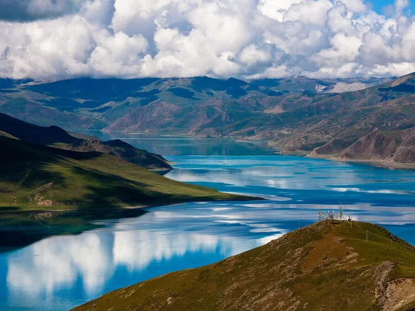
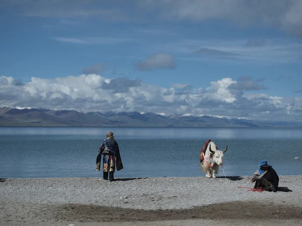
A Tibetan lake can be simultaneously a hydrological system, wildlife habitat, grazing landscape and sacred place. Those meanings should be kept together rather than reducing the site to a photo stop. Yamdrok Yumtso is a branching lake system southwest of Lhasa. Viewpoints are high and exposed, and roadside conditions can change quickly. Stay on established surfaces and do not descend to fragile shorelines merely to reproduce a social-media angle. Northern-basin lakes support specialized plants, migratory birds and wetland communities, but wildlife concentrations shift with season, water level and human activity. Binoculars are safer and less disruptive than approaching nesting or feeding areas. High ultraviolet exposure, wind and cold can be substantial even when the water is calm. Carry sun protection and insulation, and never assume that a warm midday view predicts evening conditions. Swimming, washing, drone use and collecting stones may conflict with local rules or religious practice. Ask before approaching a shrine, prayer-flag area or ritual shoreline, and take all waste away.
Lake Manasarovar and nearby Mount Kailash form a sacred cultural landscape for several religious traditions. Travel access, permits and pilgrimage protocols require current local confirmation; the sacred status is not permission to enter every shoreline area.
Six Well-Known Lakes and How They Differ
Yamdrok Yumtso — a highly indented freshwater lake system seen on the road between Lhasa and Gyantse. Its color changes with weather, viewing angle and sediment rather than because the water is permanently one shade.
Namtso — a large saline lake north of Lhasa, framed by the Nyenchen Tanglha range. A visit involves a rapid rise in sleeping or daytime altitude; read the
Namtso Lake planning guide before treating it as a simple day excursion.
Lake Manasarovar — a freshwater sacred lake in Ngari near Mount Kailash. Its importance comes from living pilgrimage traditions as well as geography; visitors should not rank it through unsupported “highest lake” superlatives.
Basum Tso — a forested lake in the Nyingchi region at a lower elevation than many central and western plateau lakes. The surrounding vegetation reflects a wetter southeastern environment.
Ranwu Lake — a lake-and-wetland landscape near the Sichuan–Tibet corridor. Seasonal inflow, sediment and weather change its appearance, so heavily edited turquoise photographs are a poor expectation guide.
Pangong Tso — a long transboundary endorheic lake in far western Ngari. Access is remote and geopolitically sensitive; travelers must use the permitted Chinese-side route and follow current photography restrictions. For every lake, confirm road and weather conditions through the
Tibet summer weather guide and local advice rather than relying on a fixed “best month.”

 Ask a Question