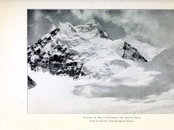
The Himalayas are a vast mountain system created by the continuing collision of the Indian and Eurasian plates, not a single ridge and not a synonym for Mount Everest. They extend across several countries and contain ten of the world's fourteen peaks above 8,000 metres; the other four are in the Karakoram. Reviewed August 29, 2026.
For travelers approaching from Tibet, the useful distinction is between studying the range, viewing a named summit and entering a controlled mountaineering area.
A photograph of a snowy horizon does not establish which peak is visible. The Everest region requires an approved route, high-altitude preparation and realistic weather expectations. Begin with the Mount Everest destination guide before comparing trekking or viewing options.
How the Himalayas Formed—and Why They Still Move
Around 40–50 million years ago, the northward-moving Indian continental plate began colliding with Eurasia. Because buoyant continental crust does not subduct as readily as dense oceanic crust, the collision shortened and thickened the crust, uplifting the Himalayas and Tibetan Plateau through faulting and folding.
The boundary remains active. GPS and seismic evidence show continuing convergence, so earthquakes, landslides and rockfall are part of the region's physical reality. “The mountains rise every year” is a useful shorthand, but uplift differs by place and erosion removes material at the same time.
Three Broad Himalayan Belts
Geologists use several regional schemes; the following is a planning-level simplification rather than a border map.
• Outer Himalaya Lower foothills formed from relatively young sediments. Warm valleys, heavy monsoon influence and landslide exposure distinguish them from the Tibetan north side.
• Lesser Himalaya Middle ranges with deeply cut valleys, settlements and complex bedrock. Elevation changes quickly, so climate and road conditions cannot be inferred from a town's latitude alone.
• Greater Himalaya The high crystalline core contains many of the tallest summits and major glaciers. Tourist viewpoints remain far below the summits yet can still exceed 5,000 metres. Review the
mountains of Tibet guide before treating every high peak as Himalayan.
Relief, Monsoon and Vertical Ecology
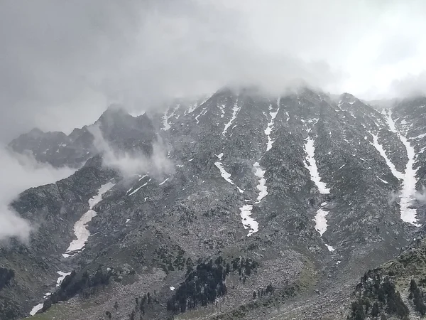
Moist summer air rises along the southern slopes, producing much heavier precipitation than on the rain-shadowed Tibetan side. The contrast is real, but “lush south, barren north” is too simple: exposure, longitude, valley orientation and winter storms all matter.
Vegetation changes with elevation and local moisture—from subtropical forests in some valleys to temperate forest, shrub, alpine meadow, cold desert, permanent snow and ice. These zones do not begin at one universal altitude. A 4,500-metre meadow and a 4,500-metre glacier margin create very different visitor conditions.
Principal High Peaks
Heights below use commonly accepted modern elevations. Rankings can change when national surveys adopt updated measurements; elevations do not describe route difficulty, prominence or access.
|
Peak
|
Elevation
|
|
Mount Everest
|
8,848.86 m
|
|
Kangchenjunga
|
8,586 m
|
|
Lhotse
|
8,516 m
|
|
Makalu
|
8,485 m
|
|
Cho Oyu
|
8,188 m
|
|
Dhaulagiri I
|
8,167 m
|
|
Manaslu
|
8,163 m
|
|
Nanga Parbat
|
8,126 m
|
|
Annapurna I
|
8,091 m
|
|
Shishapangma
|
8,027 m
|
|
Gyachung Kang
|
7,952 m
|
Glaciers, Rivers and Climate Risk
Himalayan snow and glaciers contribute to major Asian river systems, but the old claim that nearly every Indian Ocean river begins on the north slope is false. The Indus, Ganges and Brahmaputra systems receive varying shares of glacier melt, snowmelt and monsoon rain; headwaters, tributaries and seasonal dependence differ.
Glacier retreat and unstable moraine-dammed lakes can increase local flood hazards, while extreme rainfall, earthquakes and road cuts compound landslide risk. This is not a reason to avoid all travel, but it is a reason to keep weather buffers, follow closures and never camp in an unassessed drainage channel.
For an Everest journey, oxygen on a vehicle or at a hotel does not replace acclimatization. Severe headache with confusion, loss of coordination or breathlessness at rest requires urgent medical help and descent. Review the
Everest travel planning guide before committing to sleeping altitude.

 Ask a Question