Your China & Yunnan Travel Experts


 Ask a Question
This is an editorial shortlist of ten scenic bases for stargazing in China, not an official dark-sky ranking. A successful night depends less on superlatives than on cloud cover, haze, wind, the Moon and lawful after-hours access. For the Milky Way or a meteor shower, compare the forecast with the China climate guide, check moonrise and moonset, and favour the darker period around a new moon. Arrive before sunset to inspect the ground, keep clear of roads and cliff edges, and allow roughly 20–30 minutes for your eyes to adapt. A dim red lamp protects night vision better than a bright phone screen. Camera sensors also reveal more colour and detail than unaided eyes, so social-media photographs should not be treated as a visibility guarantee. The ten places below range from remote plateau and desert landscapes to managed mountain resorts. Each entry explains what the foreground contributes, when conditions are usually more workable, and—most importantly—where access, altitude or conservation rules change the plan. Operating hours and road controls were reviewed on 26 August 2026 but remain dynamic; confirm them with the scenic area, accommodation or licensed local operator shortly before travel.
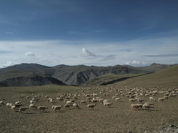
Ngari (Ali) Dark Sky Park is an astronomy visitor site near Shiquanhe in Ngari , a remote, high-altitude region of Tibet . The Ngari government identifies the National Astronomical Observatories' local station and the associated dark-sky park as part of the region's astronomy infrastructure. High elevation, dry air and distance from large cities can produce transparent nights, but none of those conditions removes cloud, wind, moonlight or altitude risk. Treat Shiquanhe as the logistics base and confirm whether the public viewing area, telescopes, transport and evening services are actually operating on your date; a research observatory is not automatically open for casual entry. Build acclimatization into a wider Tibet itinerary rather than flying in for one night. At altitude, move slowly, stay warm and do not drink alcohol to “help” with the cold. Headache, dizziness or nausea call for rest and reassessment; severe breathlessness, confusion or a rapidly worsening headache requires urgent medical care and descent or evacuation, not another exposure. International visitors should have the current Tibet travel paperwork and route arrangements confirmed by a licensed organizer before booking a remote night session. For photography, use an approved platform, shield all lights, avoid laser pointers and do not approach scientific equipment or nearby wildlife.
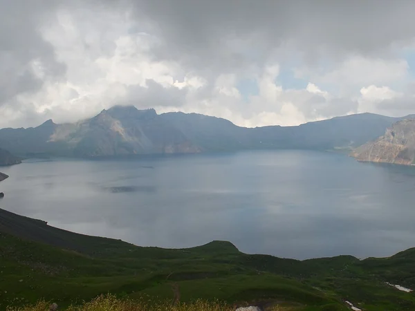
Changbai Mountain offers a dramatic volcanic and forest foreground, but the summit scenic routes are weather-sensitive and should not be confused with an unrestricted night park. Cloud and strong winds around Tianchi can erase both the crater view and the stars, while snow and ice can make an otherwise short walk hazardous. The most reliable plan is to stay in an authorized resort or town base such as Chibei, confirm that evening transport or a staffed stargazing programme is running, and photograph from a designated open area. Do not remain on a daytime trail after closing or drive onto a controlled mountain road in pursuit of clear sky. Late autumn and winter can bring longer nights and crisp air, yet extreme cold shortens battery life and raises frostbite risk; humid summer nights may have more cloud. Bring insulated layers, spare batteries close to the body, lens-heater protection against condensation and a tripod that will not obstruct a walkway. If the main scenic area closes for wind, rain or snow, switch the objective from “Tianchi under stars” to a safe forest-edge or town-side night landscape. That honest fallback is more useful than promising a view that only exists when access and weather align.
Compare Harbin winter tour ideas
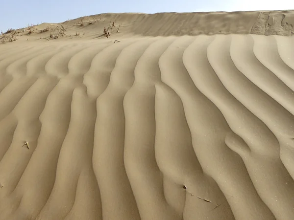
Across the Tarim Basin in southern Xinjiang , the Taklimakan Desert is China's largest desert and a vast mobile-dune landscape. Its open horizons and sparse settlement make it attractive for astronomy, but “remote” is not the same as safe or publicly accessible. Use a recognized desert park, staffed camp or agreed roadside service point rather than walking onto dunes from the desert highway. The environment is ecologically fragile, navigation features can disappear after wind, and the day–night temperature swing can be severe. A guide or host should identify the permitted viewing area, latest road conditions, fuel range, mobile coverage and emergency procedure before sunset. Never stop in a traffic lane, light a fire on vegetation, or pitch a tent simply because the ground looks empty. Spring wind and blowing sand can ruin visibility and damage equipment; the hotter months demand extra water and heat planning even when the observing session is after dark. Autumn often offers a more comfortable balance, but forecasts still decide the night. Choose a moonless window, protect the camera from sand, and compose the sky with dunes or poplar shelterbelts without entering restoration plots. The China desert guide helps compare this demanding setting with more serviced alternatives.
See a 7-day Xinjiang itinerary
See an 11-day desert-highway itinerary
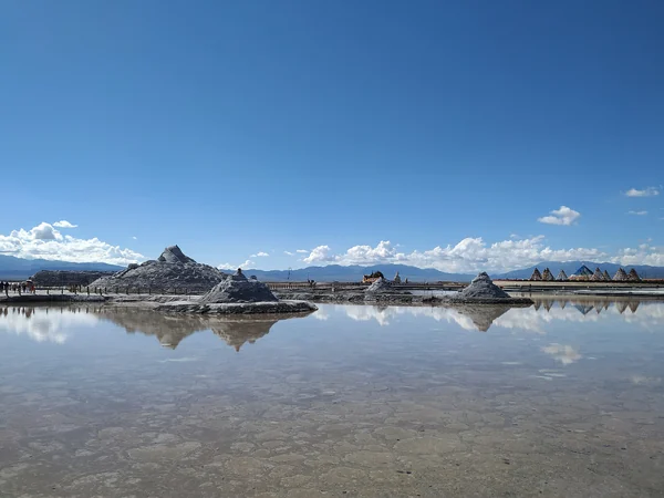
Chaka Salt Lake sits at about 3,100 metres in Qinghai and is best known for reflections on its shallow salt surface. At night, a calm, wet surface can place stars and artificial lights in the same frame, but the mirror effect depends on water depth, wind and where visitors are allowed to stand. It is not proof that the Milky Way will be visible every evening. Check the scenic area's official calendar for a specifically announced night session; a daytime ticket does not authorize remaining after closing, and railway tracks, salt-working zones and unlit water edges are not informal photography platforms. The summer event season has historically included evening programmes, but dates and last-entry times change. For a quieter image, consider the blue-hour transition and wait until bright decorative lighting is outside the camera's field of view. Salt water is corrosive, so keep tripod joints out of brine where possible, use waterproof overshoes only where permitted and clean equipment afterward. At this elevation, pace the visit, carry warm layers and watch for headache or nausea. If cloud or wind removes the stars, the lake's industrial-salt history, sunset colour and geometric tracks still provide an honest visual story—there is no need to manufacture a “perfect galaxy” claim.
See a 4-day Xining and Qinghai route
At roughly 4,700 metres, Namtso (Lake Nam) combines a broad northern horizon, dark plateau surroundings and snow-mountain silhouettes. It also has the strictest practical limitation on this list: the official scenic area can operate on daytime hours. For example, its published winter schedule in early 2026 was 09:30–18:00, with the last shuttle returning later; that notice did not create public overnight access. Plan stargazing only from an authorized lodge, village base, organized programme or other place where the operator has explicitly confirmed night access. Never walk onto winter ice, bypass a barrier or stop on an exposed road shoulder. Cold, wind and altitude can become more serious after dark, when assistance is farther away and a camera session makes it easy to ignore symptoms. Spend acclimatization time in Lhasa, keep the first night's activity light, and abandon the session if anyone deteriorates. Photographically, a crescent or quarter Moon can reveal the lakeshore and mountain form, while a darker moon window favours faint stars; those are different objectives, not better and worse versions of the same shot. Weather can close roads or alter shuttles at short notice, so call the scenic area and reconfirm transport on the day.
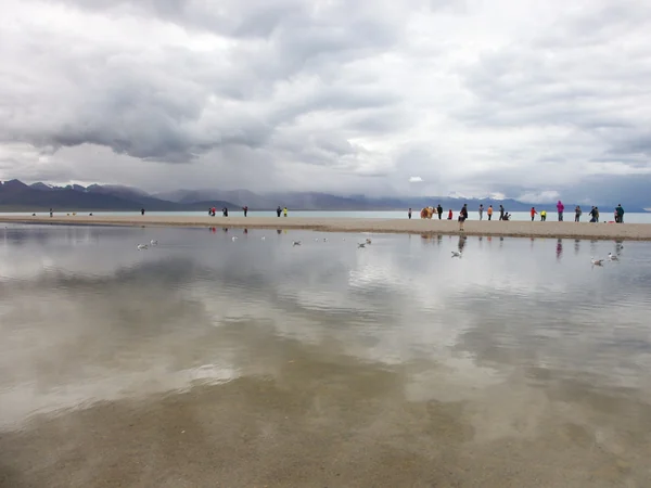
View a Lhasa-to-Namtso itinerary
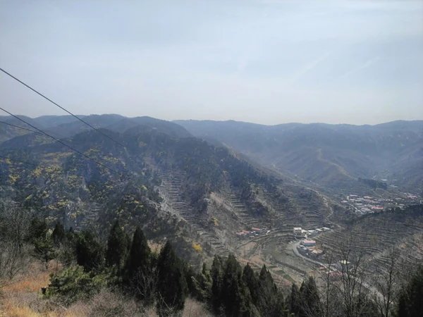
In the mountain landscape southeast of Jinan, Seven Stars Terrace (Qixingtai) is a more accessible choice than Tibet or the Taklimakan. Jinan's official attraction directory lists Qixingtai Tourism Resort as a national AAA attraction, and municipal event programmes have included organized stargazing and tent festivals here. Those facts support its observing tradition; they do not substantiate the old claim that it belongs to a formally certified “World Star Park” network. Because Jinan's light dome can remain visible on the horizon, choose a viewpoint whose open direction faces away from the city, then give your eyes time to adapt. Summer programmes may add staff and evening activity, but humidity, haze and event lighting can also reduce faint-sky contrast. Autumn's drier air is often more comfortable. Confirm the current closing time, campsite status and transport before travelling, especially outside an advertised event. Use a designated parking area, keep headlights low only after the vehicle is stationary, and avoid setting tripods in shared paths. This is a good first dark-sky outing for families because the logistics can be simpler, but children still need warm clothing and continuous supervision around unlit slopes. Binoculars, a planisphere and a red headlamp usually add more value than an oversized telescope that has not been tested.
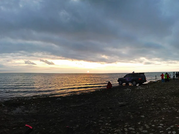
Heimahe on Qinghai Lake's southern shore is valued for wide lake views and sunrise, and the managed scenic area now provides a more responsible base than the informal lakeside stopping described in old travel posts. Qinghai's authorities have been reorganizing tourism around designated ecological viewpoints, shuttle access and protected shorelines. That means a meadow, fence opening or quiet road is not permission to park, camp or cross private grazing land. Use the Heimahe scenic area, a legal accommodation or an established campsite, and ask the operator where night photography is allowed. Seasonal traffic notices can prohibit roadside stopping along the lake circuit; after dark, livestock, wildlife and unlit vehicles increase the risk. The shore sits above 3,000 metres, so combine warm, windproof layers with a conservative first evening. A clear, moonless night can show a broad sky, while some moonlight helps define the lake and distant mountains. For composition, keep prayer flags, homes and herds contextual rather than treating them as props: do not touch religious objects, illuminate animals or enter a family's land without consent. Pack out every battery cover, hand warmer and food wrapper. If the wind is strong, move away from the exposed shore instead of weighting a tripod with loose rocks taken from the habitat.
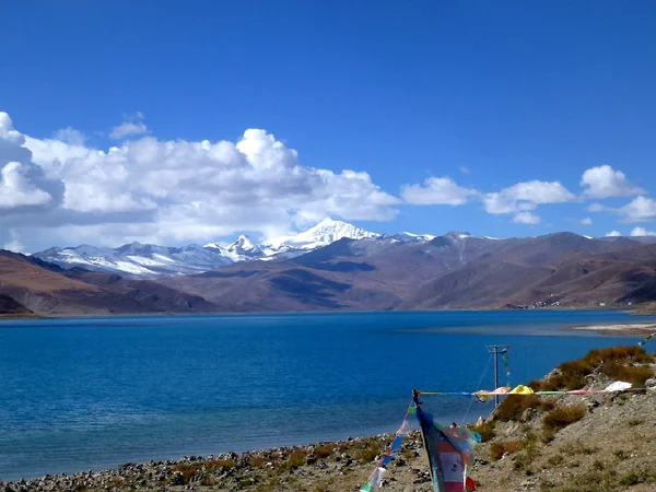
Yamdrok Lake is a high-altitude sacred lake and protected ecological landscape south of Lhasa. The established visitor route uses marked viewpoints along the G349 corridor and official platforms above or near the water. Those viewpoints give excellent daytime context, but a ticket or roadside pull-off does not automatically permit an overnight session. In 2026, the scenic area advised visitors to check same-day weather and road conditions and emphasized the lake's altitude and changeable climate. Arrange any after-dark work with an authorized local host or licensed operator, then confirm exactly which platform, parking place and return route are approved. Do not descend to an unmarked shore, fly a drone without current permission, illuminate homes or religious features, or leave the road to create a cleaner foreground. The lake's branching shape is easier to understand from the high viewpoints, while lower designated platforms can show water and mountains in a more intimate frame. A partly illuminated Moon may serve that landscape better than complete darkness. As at Namtso, acclimatization and a low-exertion plan matter more than chasing a forecast gap. If symptoms worsen or the road begins to ice, turn back; no image justifies extending exposure at more than 4,000 metres.
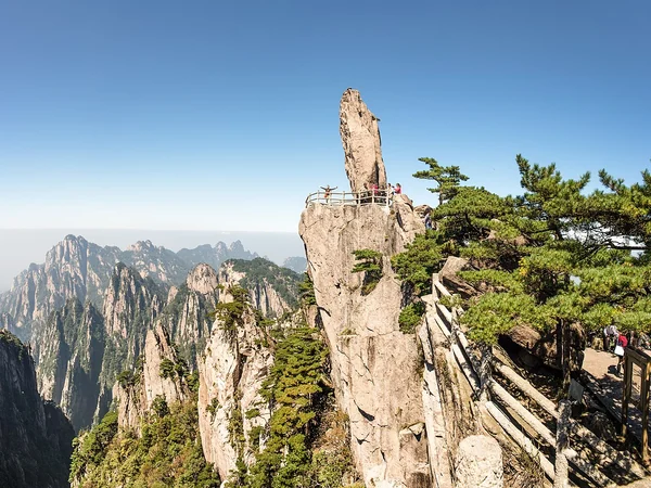
Huangshan pairs recognizable granite peaks and pines with a managed summit-area lodging network, making it one of the strongest landscape-photography choices in eastern China. The workable plan is to reserve a mountain hotel, reach it during normal transport and trail hours, and scout an authorized nearby viewpoint before dusk. Do not assume cable cars or transfer buses operate at night, and do not hike a closed path to copy a sunrise photograph. Cloud and mist are part of Huangshan's character but can hide every star; conversely, a clearing after rain may be short and paths can remain slippery. The scenic authority publishes weather, sunrise probability and operational notices, so check those instead of relying on a generic “best season.” Autumn and winter often bring longer dark hours, but cold, wind and ice demand appropriate footwear and layers. Summer may offer a visible Milky Way direction, yet convective cloud and humidity are common. Keep the tripod within a safe platform, use a dim red lamp, speak quietly near sleeping guests and avoid flash on trees or wildlife. Even on a cloudy night, the transition from dusk to illuminated lodges can make a truthful mountain story; the trip does not fail simply because a dramatic galaxy is absent.
See a 4-day Huangshan itinerary
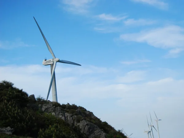
Mishailang Peak and the main summit area of Kuocang Mountain offer broad ridgelines, wind turbines and cloud-sea potential above Linhai. Local planning documents explicitly connect the mountain with “sports + starry sky + leisure” development and identify supporting facilities such as the Starry Sky Library and designated camping projects. Use those managed facilities or a confirmed legal campsite; the existence of a tourism plan does not make every lay-by or summit verge an overnight pitch. Mountain weather changes quickly, fog can erase the horizon and strong wind can overturn a tripod. Check road controls, campsite operation and any forest-fire restrictions with the current operator before driving up, then arrive in daylight to inspect barriers and escape routes. The wind turbines are a distinctive foreground, but keep outside fenced infrastructure and never illuminate blades or service buildings. Late autumn can offer clearer air; spring and early summer may produce cloud seas but also more moisture. A new-moon night favours faint stars, whereas a brighter Moon can separate layers of ridge and cloud. If visibility collapses, wait only in a safe staffed area—do not wander along the road. Pack out all waste and keep noise low so the mountain's growing night-tourism economy does not become a source of light and habitat disturbance.