Your China & Yunnan Travel Experts



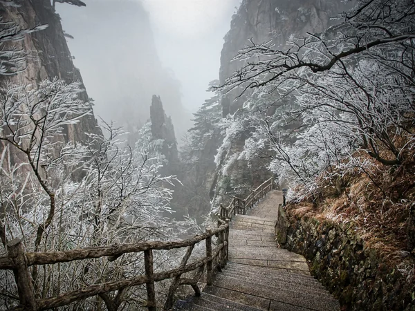
China spans tropical coasts, temperate plains, dry inland basins and high plateaus, so there is no single nationwide travel season. Latitude, elevation, monsoon circulation and distance from the sea all shape local weather. Compare the destinations on your route and use a short-range forecast before departure; mountain areas such as Huangshan can feel very different from nearby lowland cities on the same day.
Use a route-based climate check
A China itinerary should be divided into climate segments. Beijing and Xi'an have continental seasonal changes; Shanghai and the lower Yangtze are humid and influenced by the summer monsoon; Guangdong and Hainan stay warmer but can face heavy rain and tropical weather; Yunnan changes sharply with elevation; Xinjiang combines dry air with large temperature ranges; Tibet requires altitude, solar exposure and cold-night planning even in a generally mild travel month. Two cities on the same latitude can feel different because of mountains, basins, coastlines and elevation.
Start with long-term climate patterns to choose a season, then move to a ten-day and short-range forecast for operations and packing. Climate normals describe many years; they do not promise the weather for a particular date. A daily high also does not describe wind, humidity, rainfall timing or the temperature at sunrise on a mountain. Compare the hours when outdoor activities will happen, not only the headline city temperature.
Eastern and southern China are strongly influenced by the East Asian monsoon, with much of their rainfall concentrated in the warmer part of the year. Northwestern basins and deserts are generally drier, while the Qinghai-Tibet Plateau has conditions shaped by extreme elevation. The China Meteorological Administration reported that 2024 was exceptionally warm and humid nationally, a reminder that long-term averages describe a climate baseline, not the weather a traveler will actually encounter.
Topography creates local weather
Mountain destinations can be cooler, wetter and windier than the city used as their gateway. Basins may hold humidity or stagnant air, while a nearby pass is exposed to rapid change. A coastal forecast may not describe an offshore island, and a plateau city may have strong sunshine at midday followed by a cold evening. Check elevation and terrain for every major outdoor stop.
Rain timing matters as much as total rainfall. An afternoon storm may leave a morning visit workable, while several days of persistent rain can affect paths, river levels and road access. Fog can reduce the value of a viewpoint without making the whole destination unsuitable. Use flexible sequencing: schedule the most weather-sensitive activity for the best available window and keep cultural alternatives ready.
Climate classifications divide China into broad temperature and moisture zones, but boundaries differ according to the method used. The simplified categories below are a trip-planning reference. Local elevation, slope, urban heat and seasonal weather can produce substantial variation within the same named zone.
Read the tables as historical context
The city tables below are useful for comparing broad seasonal contrast, but they should not be treated as a current forecast or a guarantee. Monthly averages combine warm and cold days, while total rainfall does not show whether precipitation arrives as brief storms, several wet days or snow. Urban heat, a weather station's location and long-term climate change can also make a present journey differ from an older table.
Use the data to ask better questions. Harbin requires serious winter insulation; Beijing has hot, rainy summers and cold, dry winters; Shanghai combines humidity with a pronounced rainy season; Guangzhou and Haikou need heat and storm planning; Chengdu can feel damp with limited sunshine; Lhasa pairs strong sun with large day–night changes. For a mountain or gorge, check the attraction elevation and access road separately from the gateway city.
How to Read the Climate Information
Rainfall generally decreases from the humid southeast toward the interior northwest. Summer monsoon moisture supplies much of the annual rain in eastern China, while coastal typhoons can disrupt southern and eastern travel from late spring into autumn. Mountain weather changes quickly, and high-altitude areas may receive snow outside the lowland winter season.
|
Temperature Zone
|
Distribution Range
|
|
Cold-temperate Zone
|
north part of Heilongjiang Province and Inner Mongolia (Representative city: Harbin)
|
|
Warm-temperature
Zone
|
Jilin, northern Xinjiang, and most of Heilongjiang, Liaoning, and Inner Mongolia (Representative cities: Beijing, Shenyang, Dalian, Urumqi, Hohhot, Dunhuang, Lanzhou)
|
|
Temperature Zone
|
area of the middle and lower reaches of the Yellow River, Shandong, Shanxi, Shaanxi, and Hebei Province (Representative cities: Xian, Taiyuan, Luoyang, Jinan, Qingdao, Zhengzhou)
|
|
Subtropical Zone
|
South of isotherm of Qinling Mountain-Huaihe River, east of Qinghai-Tibet Plateau (Representative cities: Shanghai, Guangzhou, Hong Kong, Macau, Guilin, Hangzhou, Suzhou, Kunming, Dali, Lijiang, Chengdu)
|
|
Tropical Zone
|
Hainan province, southern Taiwan, Guangdong, and Yunnan Province (Representative cities: Haikou, Sanya)
|
|
Qinghai-Tibet Plateau
Temperate Zone
|
Qinghai-Tibet Plateau (Representative city: Lhasa)
|
The following cities are representatives to let you know about the temperature situations in each part of China.
Northern China – Harbin (Cold-temperate Zone)
|
Month
|
Jan
|
Feb
|
Mar
|
Apr
|
May
|
Jun
|
Jul
|
Aug
|
Sep
|
Oct
|
Nov
|
Dec
|
|
AVG TEMP (℃)
|
-19.4
|
-15.3
|
-4.8
|
6
|
14.3
|
20
|
23
|
21
|
14.4
|
5.6
|
-5.7
|
-15.6
|
|
Rainfall (mm)
|
8.2
|
5.6
|
10.2
|
18.0
|
40.2
|
84.6
|
143.8
|
121.1
|
58.6
|
31.3
|
10.8
|
6
|
|
Month
|
Jan
|
Feb
|
Mar
|
Apr
|
May
|
Jun
|
Jul
|
Aug
|
Sep
|
Oct
|
Nov
|
Dec
|
|
AVG TEMP (℃)
|
-3.7
|
-0.7
|
5.8
|
14.2
|
19.9
|
24.4
|
26.2
|
24.8
|
20.0
|
13.1
|
4.6
|
-1.5
|
|
Rainfall (mm)
|
3.0
|
7.4
|
8.6
|
19.4
|
33.1
|
77.8
|
192.5
|
212.3
|
57.0
|
24.0
|
6.6
|
2.6
|
|
Month
|
Jan
|
Feb
|
Mar
|
Apr
|
May
|
Jun
|
Jul
|
Aug
|
Sep
|
Oct
|
Nov
|
Dec
|
|
AVG TEMP (℃)
|
-1
|
2.1
|
8.1
|
14
|
19
|
25
|
26.6
|
25.5
|
19.4
|
13.7
|
6.6
|
0.7
|
|
Rainfall (mm)
|
7
|
9.6
|
29
|
43.0
|
60.2
|
54.6
|
98.8
|
71.1
|
91.6
|
60.0
|
24.0
|
6
|
|
Month
|
Jan
|
Feb
|
Mar
|
Apr
|
May
|
Jun
|
Jul
|
Aug
|
Sep
|
Oct
|
Nov
|
Dec
|
|
AVG TEMP (℃)
|
3.5
|
4.5
|
8.3
|
14
|
18.8
|
23.3
|
28
|
27.7
|
23.6
|
18
|
12.3
|
6.2
|
|
Rainfall (mm)
|
50.6
|
56.6
|
98.6
|
89.3
|
102.2
|
169.6
|
156.8
|
157.1
|
137.6
|
62.3
|
46.2
|
36.9
|
|
Month
|
Jan
|
Feb
|
Mar
|
Apr
|
May
|
Jun
|
Jul
|
Aug
|
Sep
|
Oct
|
Nov
|
Dec
|
|
AVG TEMP (℃)
|
13.3
|
14.4
|
17.9
|
21.9
|
25.6
|
27
|
28
|
28
|
27
|
24
|
19.4
|
15.1
|
|
Rainfall (mm)
|
41.6
|
70.6
|
85.6
|
201.3
|
283.2
|
275.6
|
233.8
|
227.1
|
166.6
|
87.3
|
36.2
|
32.9
|
|
Month
|
Jan
|
Feb
|
Mar
|
Apr
|
May
|
Jun
|
Jul
|
Aug
|
Sep
|
Oct
|
Nov
|
Dec
|
|
AVG TEMP (℃)
|
5.5
|
7.5
|
12.1
|
17
|
20.9
|
23.7
|
25.6
|
25.1
|
21.2
|
16.8
|
11.9
|
7.3
|
|
Rainfall (mm)
|
5
|
10
|
20
|
45
|
80
|
110
|
235
|
245
|
120
|
40
|
15
|
5
|
|
Month
|
Jan
|
Feb
|
Mar
|
Apr
|
May
|
Jun
|
Jul
|
Aug
|
Sep
|
Oct
|
Nov
|
Dec
|
|
AVG TEMP (℃)
|
21.0
|
22.3
|
26.0
|
29.7
|
31.9
|
32.9
|
33.1
|
32.3
|
30.7
|
28.4
|
25.1
|
22.0
|
|
Rainfall (mm)
|
19.5
|
35.0
|
50.6
|
100.2
|
181.4
|
227.0
|
218.1
|
235.6
|
244.1
|
224.4
|
81.3
|
34.9
|
|
Month
|
Jan
|
Feb
|
Mar
|
Apr
|
May
|
Jun
|
Jul
|
Aug
|
Sep
|
Oct
|
Nov
|
Dec
|
|
AVG TEMP (℃)
|
-10.7
|
-7.7
|
-0.4
|
8.4
|
14.9
|
19.2
|
20.9
|
20
|
14.3
|
6.3
|
-2
|
-8.3
|
|
Rainfall (mm)
|
0.8
|
1.2
|
2.9
|
6.1
|
27.7
|
71.2
|
116.6
|
120.6
|
68.3
|
8.8
|
1.3
|
1.0
|
Choose dates by matching the route with the experience you want. Spring tours suit blossoms and mild city walks, while summer tours need heat, rain and crowd planning. The autumn destination guide and autumn tour collection help with clear-weather and foliage routes. Winter tours can focus on snow, lower-season cultural travel or warm southern regions; the Harbin Ice and Snow Festival tour is a destination-specific example. Use the China guide book for wider planning, then check a reliable short-range forecast immediately before each travel day.
Weather risks that change the itinerary
Heavy rain can close mountain paths, raise river levels and delay road or rail travel. Typhoons may affect southern and eastern coasts and can disrupt flights well beyond the point of landfall. Summer heat increases dehydration risk during exposed city walks. Winter cold, ice and snow affect northern roads and steps. Dust events can occur in northern and northwestern areas, while high-altitude weather can change quickly. Follow official local notices and attraction instructions rather than relying on a generic seasonal article.
Pack for transitions, not one average
Layering works better than one bulky item on a multi-city route. Add sun protection, rain protection and footwear with reliable grip; carry water where permitted. For humidity, quick-drying clothing is useful. For cold regions, protect hands, feet and head rather than focusing only on a coat. Travelers with asthma, cardiovascular conditions, heat sensitivity or limited mobility should discuss suitable activity with a qualified professional and schedule indoor alternatives. Wet stone, snow, cable-car queues and high temperatures can make an otherwise accessible attraction harder to use.
Reserve one flexible half-day on weather-sensitive routes. Put museums, food experiences or neighborhood visits in the plan as genuine alternatives, not emergency filler. Recheck forecasts before every outdoor transfer, and confirm whether the attraction, cruise, cableway or trail is operating.
11 Days China Wonders Experience Tour
Editorial accountability
Hu Lei, CEO. The named owner is responsible for travel-planning accuracy and escalation of time-sensitive checks.
Yuntian Travel (Yunnan) Group is identified in its corporate profile as a licensed professional inbound travel service provider based in Kunming, China. Registration and travel-service documents can be requested before booking.
Page-specific references where cited, official destination, transport and entry notices, YUNSKY route-planning records, and direct provider confirmation before a booking is finalized.
Content is reviewed when rules, transport, access, pricing or route conditions change. Final availability and operating details are reconfirmed for each traveler’s dates.
Quality review: Page updated: