Your China & Yunnan Travel Experts

 Ask a Question
Ancient Silk Road networks crossed present-day northwestern China through routes that began around Chang'an, continued via Xian , Lanzhou , Jiayuguan , Dunhuang in Gansu , then entered oasis systems around Turpan , Urumqi and Kashgar in Xinjiang .
These were changing corridors rather than one road. Mountain passes, water, political control and the fortunes of individual kingdoms determined which branch was usable. Xinjiang's archaeological record includes oasis towns, cemeteries, manuscripts, textiles and art created by communities with different languages and beliefs. Read that evidence within the wider history of the Silk Road, examine one famous oasis through the guide to ancient Loulan, and compare practical stops in the Silk Road destinations guide. Modern administrative boundaries should not be projected unchanged onto ancient kingdoms.
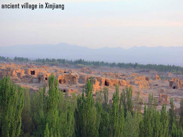
Xinjiang lies between major mountain systems and contains the Tarim and Junggar basins. The Tian Shan divides much of the region, while the Taklamakan occupies the center of the Tarim Basin. Historical travel concentrated around oasis margins where snowmelt and local water systems could support farming and settlement. A map that shows only a line across empty desert misses the economic importance of those communities.
Long-distance exchange existed before the Han court established a stronger presence in the Western Regions. From the late second century BCE onward, diplomacy, garrisons and missions associated with Zhang Qian connected the Han state more directly with established Central Asian societies. Control remained uneven, and later dynasties, local kingdoms, nomadic powers and merchant communities reshaped the network.
Languages and religions encountered in Xinjiang included forms of Iranian and Turkic speech, Chinese, Sanskrit and other written traditions. Buddhism, Manichaeism, Zoroastrianism, Christianity and later Islam appear in different places and periods. This diversity did not develop as a simple blend: communities traded, translated, competed and governed under changing political conditions.
For travelers, Turpan offers comparatively accessible earthen cities and irrigation landscapes, while Kashgar provides a living urban and regional context. Remote archaeological zones around Lop Nur are not ordinary self-drive attractions. Access, conservation controls and road conditions can change, so use authorized routes and current local guidance rather than coordinates copied from an expedition story.
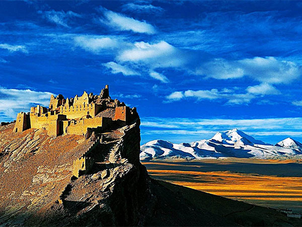
No. 1 The Mystery of Ancient Loulan City
Loulan was an oasis polity near the shifting waters of Lop Nur and occupied a strategic position on routes around the Taklamakan. Its decline was not a city-wide disappearance on one dramatic night. Changing water supply, route geography, conflict and political realignment are among the factors historians examine. The surviving remains are fragile evidence, not an abandoned film set.
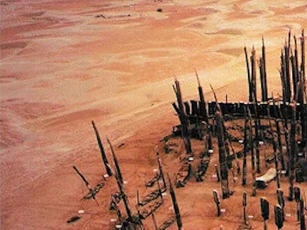
No. 2 The Mystery of the Sun Tomb
The “Sun Tomb” name refers to a cemetery layout in which wooden posts form striking radial and circular patterns. Archaeology can document construction, burial practice, materials and chronology, but the builders did not leave a simple explanation of the design. Calling it mysterious is reasonable only if it leads to questions about evidence—not paranormal claims.
Large quantities of timber in an arid landscape also raise practical questions about past vegetation, transport and labor. Images should be read with the excavation plan and site report because an aerial composition alone cannot identify belief or ethnicity.
The cemetery environment is highly sensitive. Travelers should not assume it is open or attempt an independent desert approach.
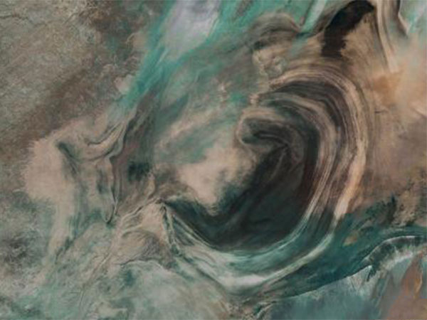
No. 3 The Mystery of “Big Ear”
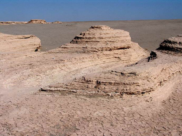
Satellite images have made the former Lop Nur lake basin famous for an ear-like outline. Repeated shorelines, salt deposits, sediment and changing water coverage can create large-scale patterns visible from above. The resemblance is a visual nickname, not evidence that the landform was designed.
No. 4 The Mystery of Desert Disappearances
Lop Nur is remote, dry and exposed to heat, cold, wind and navigation risk. Real accidents should not be packaged as a supernatural “triangle.” Entry restrictions may relate to safety, conservation or other land controls. A responsible account emphasizes permits, professional logistics and respect for people who lost their lives.
No. 5 The Mystery of the Niya Sites
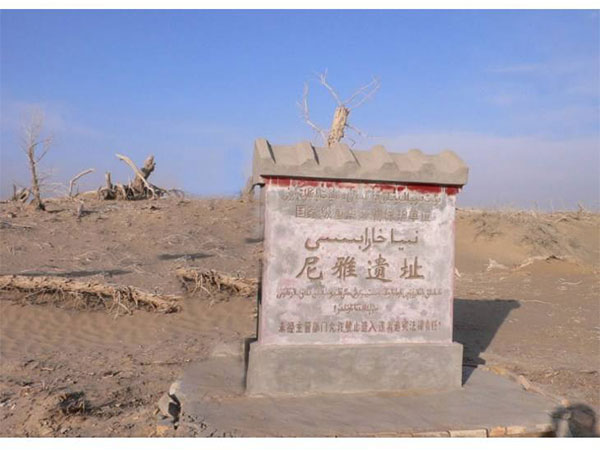
The Niya ruins are commonly associated with the ancient kingdom known in Chinese records as Jingjue. Houses, documents, wooden objects and agricultural traces reveal an oasis society connected to wider exchange. The site's modern history also includes foreign expeditions and the dispersal of finds, so museum interpretation should state where an object was recovered and where it is now held.
Sand preservation can make ruins look suddenly abandoned, but archaeology must distinguish occupation phases rather than invent a single catastrophe. Remote access is controlled and should never be improvised.
No. 6 The Mystery of the Kanas Lake “Monster”
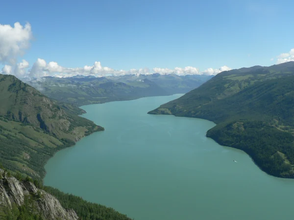
Kanas Lake is a high-latitude mountain lake surrounded by forest and alpine scenery. Stories about a large unidentified creature belong to local legend and modern tourism culture; they are not confirmed zoological evidence. Visit for the lake, seasonal landscape and regional cultures, and avoid treating an unverified story as a scientific fact.
No. 7 The Mystery of Rock Paintings
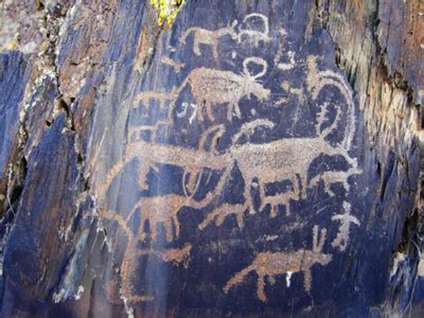
Xinjiang rock art records animals, hunting, herding, movement and symbolic imagery across different locations and periods. Dating and interpretation depend on style, weathering, archaeological context and comparison. Do not touch, trace with chalk, wet or climb onto carvings for photography.
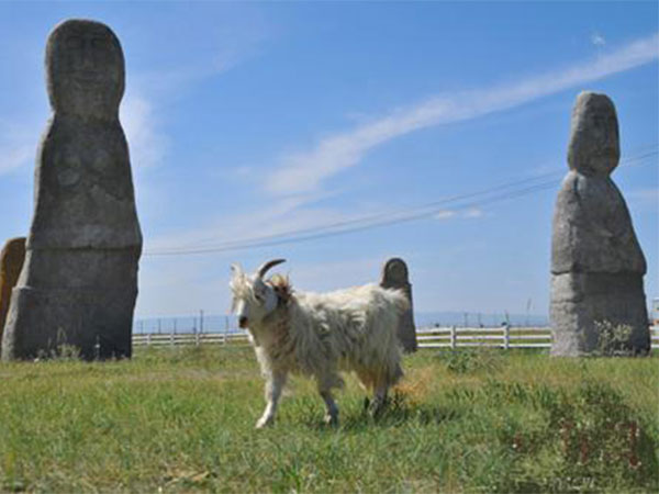
No. 8 The Mystery of Stone Statues
Stone figures found across steppe regions are often discussed in relation to Turkic-period memorial landscapes, although dates and functions vary by site. A statue without its surrounding stones, inscriptions or excavation context cannot identify one tribe by appearance alone. Museum labels should separate documented provenance from later folklore.
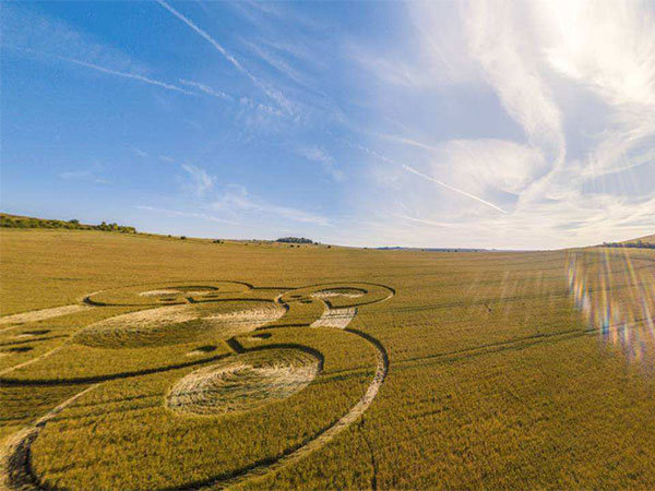
No. 9 The Mystery of Crop Circles
Geometric patterns in modern fields are usually human-made or produced by agricultural and environmental processes. They are not evidence of an ancient Silk Road culture unless a dated archaeological context demonstrates a connection. A photograph of a field pattern should therefore be presented as a modern curiosity, not an unresolved ancient monument.
This topic is a useful test of source quality: ask who documented the pattern, when it appeared, whether the site was examined, and whether an explanation was published.
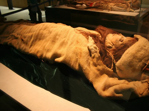
No. 10 The Mystery of Xinjiang Mummies
Dry conditions preserved human remains and textiles at several Tarim Basin cemeteries. These individuals belonged to different communities and periods; appearance alone cannot establish ethnicity, language or a direct migration story. Archaeogenetic research continues to refine interpretations, and summaries should be updated when peer-reviewed evidence changes. Human remains deserve respectful language. Follow museum photography rules and avoid sensational labels that reduce a person to an exotic “beauty.”
From $ 3510
From $ 3061

From $ 3683