Your China & Yunnan Travel Experts


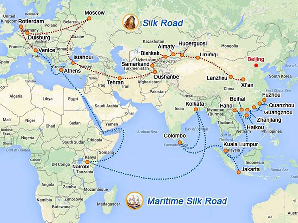
The Silk Road was not a single paved highway from Xian to Rome. It was a changing network of land and sea corridors that connected Chinese capitals and production centers with Central Asia and regions farther west through many intermediaries.
The name reflects silk's symbolic importance, but horses, glass, metals, paper-making knowledge, religions, artistic styles and many other goods and ideas also moved through these networks. Use the Hexi Corridor guide to understand the central channel, compare conditions in the Silk Road climate guide, and turn the history into a modern route with the tour-planning guide.
Within present-day China, routes shifted with politics, water sources, security and trade. Three broad branches are useful for orientation, but they should not be mistaken for permanent, exclusive lines.
Northern Tianshan branch:
From the Hexi Corridor through Hami and areas north of the Tianshan toward Ili and Central Asia. A modern traveler cannot reproduce this as one simple sightseeing road.
Northern Tarim Basin branch:
From Dunhuang toward Hami and Turpan, then along northern-oasis centers such as Kuqa and Aksu toward Kashgar and the Pamirs.
Southern Tarim Basin branch:
From Dunhuang toward Loulan-area routes and southern oases including Niya and Hotan before Kashgar and passes toward Central Asia.
For practical travel, the most accessible interpretive chain is: Xian → Lanzhou → Jiayuguan → Dunhuang → Turpan → Urumqi → Kashgar . This sequence is a modern planning spine, not proof that every historic traveler followed it end to end.
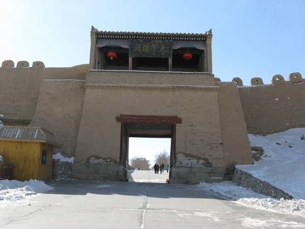
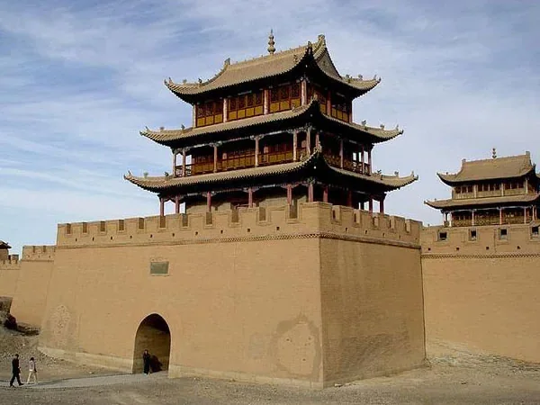
Xian introduces imperial capitals and the eastern context for westward diplomacy, trade and Buddhism. Lanzhou is a Yellow River transport hub and a useful gateway into the Hexi Corridor. Jiayuguan shows the later Ming frontier system; it should not be presented as the origin of Han-era Silk Road movement. Dunhuang explains a major oasis crossroads through Mogao art, manuscripts and desert geography. Turpan connects oasis agriculture, ancient city sites and routes north of the Taklamakan. Urumqi serves today as Xinjiang's main transport hub, although its modern importance differs from the older oasis network. Kashgar sits near routes toward the Pamirs and Central Asia. Its Old City remains a living urban environment, so visit respectfully and avoid reducing local culture to a museum display.
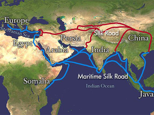
Maritime exchange linked Chinese ports with Southeast Asia, South Asia, the Gulf and East Africa across different periods. Seaborne routes developed alongside land corridors rather than replacing them in one dynasty. Port importance shifted with ship technology, state policy, monsoon knowledge and regional trade; Quanzhou, Guangzhou and other coastal centers belong to this wider story.
Northeast routes connected Chinese ports with the Korean Peninsula and Japan.
Southern routes connected coastal China with mainland and island Southeast Asia.
Western routes continued through South Asia and the Arabian Sea toward Gulf and East African ports. These labels simplify a web of seasonal voyages and intermediary ports, so they should be used for orientation rather than as fixed modern cruise itineraries.
From $ 3510
From $ 3061

From $ 3683
Editorial accountability
Hu Lei, CEO. The named owner is responsible for travel-planning accuracy and escalation of time-sensitive checks.
Yuntian Travel (Yunnan) Group is identified in its corporate profile as a licensed professional inbound travel service provider based in Kunming, China. Registration and travel-service documents can be requested before booking.
Page-specific references where cited, official destination, transport and entry notices, YUNSKY route-planning records, and direct provider confirmation before a booking is finalized.
Content is reviewed when rules, transport, access, pricing or route conditions change. Final availability and operating details are reconfirmed for each traveler’s dates.
Quality review: Page updated:
