Your China & Yunnan Travel Experts

 Ask a Question
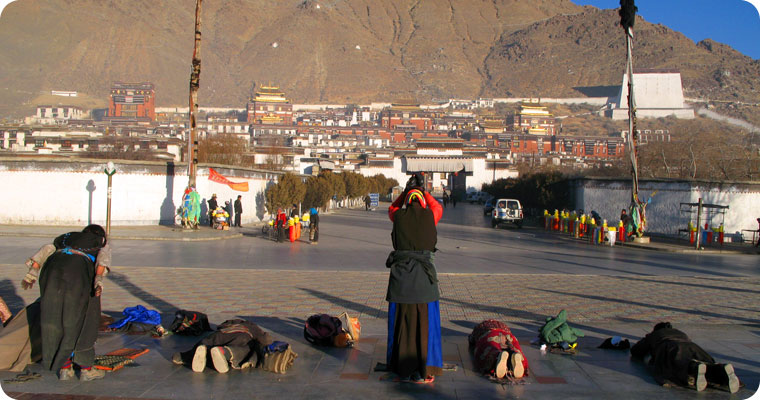
Reviewed August 27, 2026. Tibet Autonomous Region occupies the southwestern part of China on the Qinghai–Tibet Plateau. Its scale is difficult to understand from a short stop in Lhasa: high basins, broad grasslands, river valleys, alpine lakes, glacier-fed ranges and the humid gorges of the southeast create several distinct travel environments. The National People's Congress reference profile gives an area of about 1.22 million square kilometres and an average elevation above 4,000 metres; individual destinations differ greatly. Lhasa lies near 3,650–3,700 metres, while road passes and highland sites can be considerably higher. Treat elevation as an itinerary constraint, not a dramatic selling point. Begin with a low-effort arrival period, identify the highest sleeping altitude and avoid stacking long drives, stair-heavy monuments and a rapid ascent into the first days.
The region's cultural landscape is equally layered. Tibetan language, Buddhist traditions, farming and pastoral life, trade routes, historic monasteries and contemporary towns are living parts of the place—not scenery staged for visitors. UNESCO's Historic Ensemble of the Potala Palace includes the Potala Palace, Jokhang Temple and Norbulingka, each protected for architecture, art and its relationship to Lhasa's landscape. Visit respectfully: follow photography rules, do not interrupt worship or prostration, walk clockwise where the local site requests it, dress for active religious spaces and ask before photographing a person. For historical context that separates documented periods from legend, continue to the Tibet history guide.
Use this overview as a decision map rather than a checklist. First decide whether your priority is Lhasa heritage, a gentler valley journey, a rail approach, high-altitude scenery or a longer expedition. Then compare travel time, sleeping altitude, seasonal road exposure, toilet and heating standards, medical access and the number of consecutive driving days. The best-known route is not automatically the best first route. A traveler who enjoys architecture but dislikes long high passes may gain more from Lhasa and nearby valleys than from racing toward Everest. Someone focused on landscapes needs weather buffers and honest drive times more than extra attractions.
Rules for foreign visitors, permits, transport and protected areas can change. Verify current requirements for your nationality and route with the responsible Chinese authority and a licensed operator before paying non-refundable costs; border and local authorities make final decisions. Recheck attraction reservations, opening hours and photography limits close to travel. This page gives durable planning principles and flags facts that can change, while the Tibet destinations guide helps compare places and the Tibet transportation guide explains route trade-offs. Health guidance here is general: high-altitude travelers should consult a qualified clinician when personal risk factors apply.
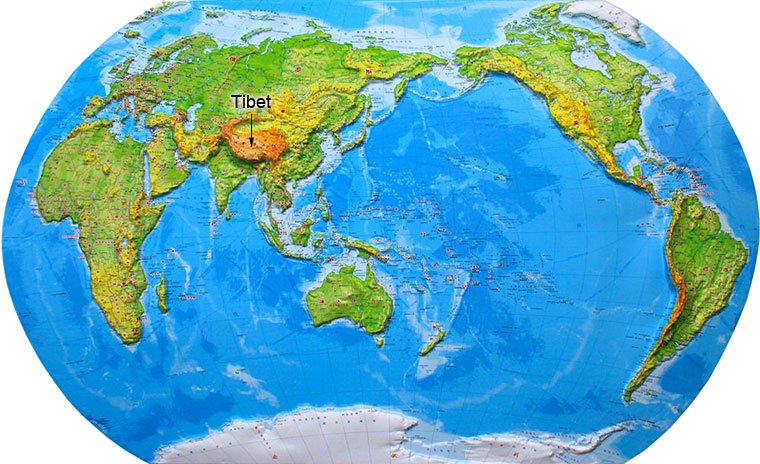
Regional capital Lhasa, the main arrival hub and cultural centre of the region
Approximate area About 1.22 million square kilometres; figures should be read as regional scale, not usable touring distance
People and settlement Population is concentrated in cities and cultivable river valleys; broad highland areas remain sparsely settled. Current population figures change and should be checked in the latest official statistical bulletin.
Tibetan communities are the principal cultural presence, alongside Han, Hui, Monba, Lhoba and other groups. Avoid reducing language, religion or dress to one stereotype; practices vary by place, generation and occasion.
Administrative structure The region is administered through Lhasa and the prefecture-level areas of Shigatse, Shannan, Nyingchi, Chamdo, Nagqu and Ngari. Verify current spellings and boundaries with official sources.