Your China & Yunnan Travel Experts



Within this best mountain hiking in China guide, the editorial focus is fitness, stair volume, escape options and mountain-weather safety. Planning approach for Mount Tai (Taishan): Choose between the full Red Gate ascent and a cableway-assisted upper walk according to knees, stamina and available daylight. Tai'an is the gateway; confirm shuttle, cableway and night-access arrangements with the scenic area. Allow enough time for walking, transfers and an alternative if the main outdoor condition is poor. Route decision: Tai'an is the gateway; confirm shuttle, cableway and night-access arrangements with the scenic area. Choose between the full Red Gate ascent and a cableway-assisted upper walk according to knees, stamina and available daylight. Compare the time spent reaching this stop with the time available on site before adding it to a multi-region China itinerary.
Recommended Hiking Routes at Tai Mountain
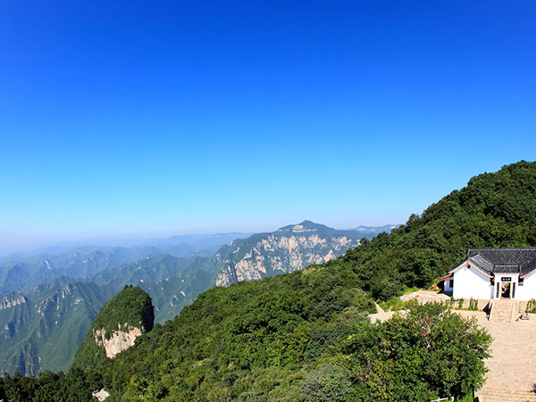
Classic Route(Available at nights): Red Gate Palace-Halfway Gate to Heaven-South Gate to Heaven-Jade Emperor Peak
This route is long and you may need more than 6 hours to get to the top of the Tai Mountain. And it is the most classic route in Tai Mountain to see most attractions at Tai Mountain. If you want to challenge yourself, you can choose hiking to get to the top of Tai Mountain. And if you want to save energy and time, you can choose cable car to get to the South Gate to Heaven. Then hike a relaxing route to get to the top of Tai Mountain.
Relaxing Route: South Gate to Heaven-Jade Emperor Peak
Within this best mountain hiking in China guide, the editorial focus is fitness, stair volume, escape options and mountain-weather safety. Planning approach for Mount Tai (Taishan): Choose between the full Red Gate ascent and a cableway-assisted upper walk according to knees, stamina and available daylight. Tai'an is the gateway; confirm shuttle, cableway and night-access arrangements with the scenic area. Allow enough time for walking, transfers and an alternative if the main outdoor condition is poor. Route decision: Tai'an is the gateway; confirm shuttle, cableway and night-access arrangements with the scenic area. Choose between the full Red Gate ascent and a cableway-assisted upper walk according to knees, stamina and available daylight. Compare the time spent reaching this stop with the time available on site before adding it to a multi-region China itinerary.
Newest Route: East Imperial Road-East Heaven Gate-Halfway Gate to Heaven-South Gate to Heaven-Jade Emperor Peak
Travel Tips for Tai Mountain Hiking
Within this best mountain hiking in China guide, the editorial focus is fitness, stair volume, escape options and mountain-weather safety. Practical limits matter at Mount Tai (Taishan). The long stone staircase is repetitive and slippery when wet, so stable footwear matters more than speed. Spring and autumn often offer comfortable hiking conditions, but summit wind, rain or ice can change the route. A flexible plan usually produces a better experience than promising one view, species or bloom on one fixed day. Planning approach for Mount Tai (Taishan): Choose between the full Red Gate ascent and a cableway-assisted upper walk according to knees, stamina and available daylight. Tai'an is the gateway; confirm shuttle, cableway and night-access arrangements with the scenic area. Allow enough time for walking, transfers and an alternative if the main outdoor condition is poor.
Within this best mountain hiking in China guide, the editorial focus is fitness, stair volume, escape options and mountain-weather safety. Mount Tai combines a historic pilgrimage stairway, temples, inscriptions and a summit landscape rather than a wilderness trail. Choose between the full Red Gate ascent and a cableway-assisted upper walk according to knees, stamina and available daylight. This makes Mount Tai (Taishan) most useful to travelers who value informed observation over a rushed checklist. Season and conditions: Spring and autumn often offer comfortable hiking conditions, but summit wind, rain or ice can change the route. The long stone staircase is repetitive and slippery when wet, so stable footwear matters more than speed. Check current forecasts, tickets and access notices shortly before travel rather than relying on a permanent date or timetable.
Within this best mountain hiking in China guide, the editorial focus is fitness, stair volume, escape options and mountain-weather safety. Planning approach for Mount Tai (Taishan): Choose between the full Red Gate ascent and a cableway-assisted upper walk according to knees, stamina and available daylight. Tai'an is the gateway; confirm shuttle, cableway and night-access arrangements with the scenic area. Allow enough time for walking, transfers and an alternative if the main outdoor condition is poor. Route decision: Tai'an is the gateway; confirm shuttle, cableway and night-access arrangements with the scenic area. Choose between the full Red Gate ascent and a cableway-assisted upper walk according to knees, stamina and available daylight. Compare the time spent reaching this stop with the time available on site before adding it to a multi-region China itinerary.
Within this best mountain hiking in China guide, the editorial focus is fitness, stair volume, escape options and mountain-weather safety. Season and conditions: Spring and autumn often offer comfortable hiking conditions, but summit wind, rain or ice can change the route. The long stone staircase is repetitive and slippery when wet, so stable footwear matters more than speed. Check current forecasts, tickets and access notices shortly before travel rather than relying on a permanent date or timetable. Practical limits matter at Mount Tai (Taishan). The long stone staircase is repetitive and slippery when wet, so stable footwear matters more than speed. Spring and autumn often offer comfortable hiking conditions, but summit wind, rain or ice can change the route. A flexible plan usually produces a better experience than promising one view, species or bloom on one fixed day.
Within this best mountain hiking in China guide, the editorial focus is fitness, stair volume, escape options and mountain-weather safety. Planning approach for Mount Hua (Huashan): A west-up/north-down circuit reduces repeated walking, while a foot ascent from Yuquan Temple is a much harder undertaking. Huayin is reached conveniently from Xi'an by rail, followed by scenic shuttles and the chosen cableway. Allow enough time for walking, transfers and an alternative if the main outdoor condition is poor. Route decision: Huayin is reached conveniently from Xi'an by rail, followed by scenic shuttles and the chosen cableway. A west-up/north-down circuit reduces repeated walking, while a foot ascent from Yuquan Temple is a much harder undertaking. Compare the time spent reaching this stop with the time available on site before adding it to a multi-region China itinerary. Continue planning with the China hiking route guide.
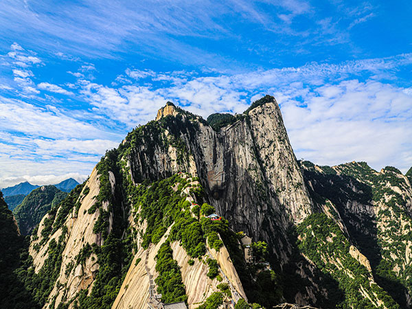
Recommended Route at Hua Mountain
Route 1: West Peak-South Peak-East Peak-North Peak
Within this best mountain hiking in China guide, the editorial focus is fitness, stair volume, escape options and mountain-weather safety. Practical limits matter at Mount Hua (Huashan). The famous plank walk is optional, controlled and not appropriate for every traveler; never frame it as a required hike. Avoid high wind, thunderstorms, ice and poor visibility; some exposed activities may close independently of the main mountain. A flexible plan usually produces a better experience than promising one view, species or bloom on one fixed day. Planning approach for Mount Hua (Huashan): A west-up/north-down circuit reduces repeated walking, while a foot ascent from Yuquan Temple is a much harder undertaking. Huayin is reached conveniently from Xi'an by rail, followed by scenic shuttles and the chosen cableway. Allow enough time for walking, transfers and an alternative if the main outdoor condition is poor.
Route 2: Yuquan Temple-North Peak-Halfway Peak-West Peak
Within this best mountain hiking in China guide, the editorial focus is fitness, stair volume, escape options and mountain-weather safety. Planning approach for Mount Hua (Huashan): A west-up/north-down circuit reduces repeated walking, while a foot ascent from Yuquan Temple is a much harder undertaking. Huayin is reached conveniently from Xi'an by rail, followed by scenic shuttles and the chosen cableway. Allow enough time for walking, transfers and an alternative if the main outdoor condition is poor. Route decision: Huayin is reached conveniently from Xi'an by rail, followed by scenic shuttles and the chosen cableway. A west-up/north-down circuit reduces repeated walking, while a foot ascent from Yuquan Temple is a much harder undertaking. Compare the time spent reaching this stop with the time available on site before adding it to a multi-region China itinerary.
Within this best mountain hiking in China guide, the editorial focus is fitness, stair volume, escape options and mountain-weather safety. Planning approach for Wugong Mountain: Choose between the full Red Gate ascent and a cableway-assisted upper walk according to knees, stamina and available daylight. Tai'an is the gateway; confirm shuttle, cableway and night-access arrangements with the scenic area. Allow enough time for walking, transfers and an alternative if the main outdoor condition is poor. Route decision: Tai'an is the gateway; confirm shuttle, cableway and night-access arrangements with the scenic area. Choose between the full Red Gate ascent and a cableway-assisted upper walk according to knees, stamina and available daylight. Compare the time spent reaching this stop with the time available on site before adding it to a multi-region China itinerary. Continue planning with the China spring destinations.
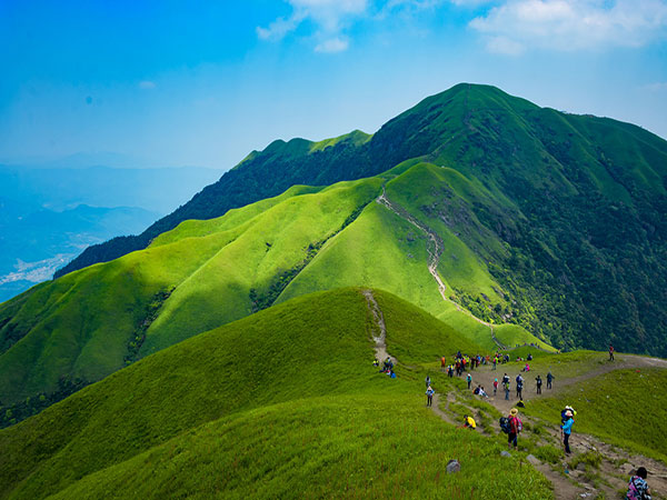
Recommended Hiking Route at Wugong Mountain
Classic Route: Shigu Temple-Monkey Valley-Golden Top-Diaomazhuang-Hero Stop-Ziji Palace(Zhongan)
Within this best mountain hiking in China guide, the editorial focus is fitness, stair volume, escape options and mountain-weather safety. Practical limits matter at Wugong Mountain. Exposed ridges offer little shelter, so avoid a rigid summit plan when storms are forecast. Green ridges are associated with warmer months, but fog, rain and thunderstorms can sharply reduce visibility. A flexible plan usually produces a better experience than promising one view, species or bloom on one fixed day. Planning approach for Wugong Mountain: Decide between a day route and an overnight ridge experience, and verify where cableway assistance begins and ends. Pingxiang is a common gateway; the last transfer to the trailhead should be confirmed before arrival. Allow enough time for walking, transfers and an alternative if the main outdoor condition is poor.
Within this best mountain hiking in China guide, the editorial focus is fitness, stair volume, escape options and mountain-weather safety. Planning approach for Mount Emei: The cableway-assisted Leidongping route suits sightseeing, while the traditional lower-to-upper trail requires substantially more time and climbing. Emeishan city is the gateway; scenic buses connect major zones, but queues and transfers lengthen the day. Allow enough time for walking, transfers and an alternative if the main outdoor condition is poor. Route decision: Emeishan city is the gateway; scenic buses connect major zones, but queues and transfers lengthen the day. The cableway-assisted Leidongping route suits sightseeing, while the traditional lower-to-upper trail requires substantially more time and climbing. Compare the time spent reaching this stop with the time available on site before adding it to a multi-region China itinerary. Continue planning with the China tours.
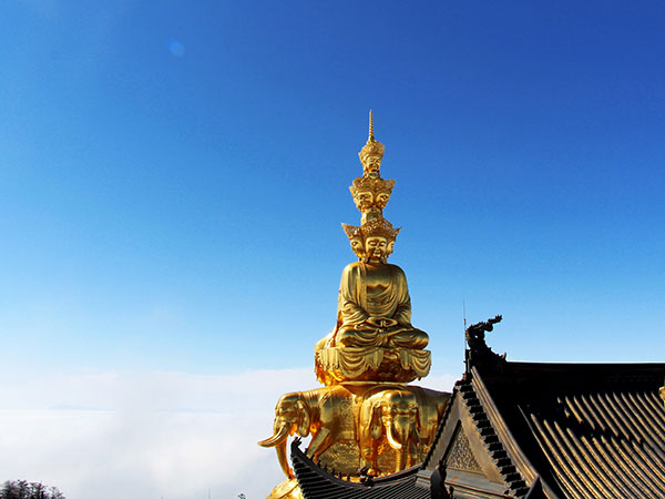
Recommended Hiking Route at Mount Emei
Relaxing Route: Leidongping-Jieyin Palace-Shuzhuangtai-Taiziping-Golden Top
It is a relaxing route at Mount Emei, by which you can see the highlights of Mount Emei. At this route, you can visit the Huacang Temple and the Golden Buddha, the highest golden Buddha in the world. Standing on the Golden Top, sometimes you can see the Chengdu Plateau and Minya Konka Snow Mountain. This route takes about 3 hours to get to the Golden Top from Leidongping. And this section is a bit steep. If you do not want to spend more than 14 hours to hike for the whole route, you can choose this hiking route with the highlights of Mount Emei.
Complete Route:
Day 1: Baoguo Temple-Fuhu Temple-Leiyin Temple-Guangfu Temple-Jiulao Cave-Dufeng Temple-Yuxian Temple-Jiugangling-Xixiang Pool-Leidongping
Day 2: Leidongping-Jieyin Palace-Shuzhuangtai-Taiziping-Golden Top
This route is a complete route including most of the attractions at Mount Emei. Generally speaking, you should spend more than 14 hours to finish all this route. And it is not recommended that you finish this hiking route in a day because you need time to relax after hiking for a long time. You can fully experience the scenery and religious culture of Mount Emei at this route with the temples and other attractions. And please note that the hiking footpath at Mount Emei will be closed because of weather. Please check with the scenic area in advance to avoid the situation of closing of hiking footpath.
Travel Tips at Mount Emei
Editorial accountability
Hu Lei, CEO. The named owner is responsible for travel-planning accuracy and escalation of time-sensitive checks.
Yuntian Travel (Yunnan) Group is identified in its corporate profile as a licensed professional inbound travel service provider based in Kunming, China. Registration and travel-service documents can be requested before booking.
Page-specific references where cited, official destination, transport and entry notices, YUNSKY route-planning records, and direct provider confirmation before a booking is finalized.
Content is reviewed when rules, transport, access, pricing or route conditions change. Final availability and operating details are reconfirmed for each traveler’s dates.
Quality review: Page updated: