Your China & Yunnan Travel Experts


The Ming replaced the Yuan in 1368. Rather than beginning from a blank map, the new dynasty inherited older defensive landscapes and faced continuing military competition across the northern frontier.
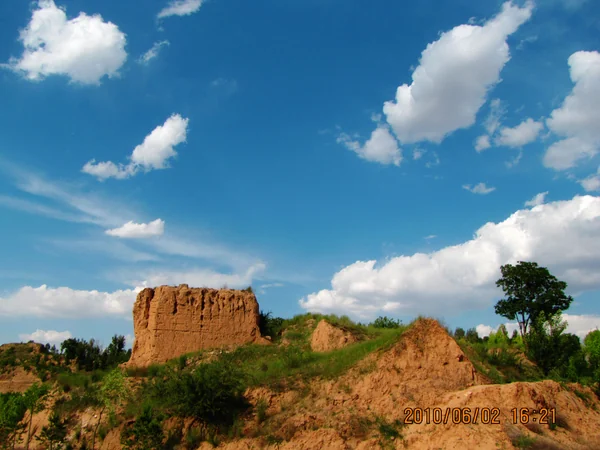
Construction focused on strategic sectors and evolved over generations. Some lines followed or paralleled earlier Northern Qi and other walls; others used new alignments. Local materials shaped appearance, from tamped earth in the northwest to masonry-faced walls near major eastern approaches.
The Ming Great Wall's importance lies in its scale, regional variety and relationship to military administration. It did not make the frontier impermeable, and it did not end exchange across it. Most managed sections around Beijing—including Jinshanling—show Ming fabric or restoration based on it; active walkers can use the Gubeikou–Jinshanling route guide to plan responsibly. UNESCO inscribed the Great Wall in 1987. Visitors should distinguish original masonry, later repair and modern reconstruction while protecting all three as parts of the site's continuing history.
From $ 389

From $ 509

From on request
Editorial accountability
Hu Lei, CEO. The named owner is responsible for travel-planning accuracy and escalation of time-sensitive checks.
Yuntian Travel (Yunnan) Group is identified in its corporate profile as a licensed professional inbound travel service provider based in Kunming, China. Registration and travel-service documents can be requested before booking.
Page-specific references where cited, official destination, transport and entry notices, YUNSKY route-planning records, and direct provider confirmation before a booking is finalized.
Content is reviewed when rules, transport, access, pricing or route conditions change. Final availability and operating details are reconfirmed for each traveler’s dates.
Quality review: Page updated: