Your China & Yunnan Travel Experts


Main Airports in Tibet: Gateways, Altitude and Transfers

Flying can connect Lhasa and regional centers quickly, but it also moves travelers from low elevation to high altitude with little acclimatization. As of the reviewed date, the regional civil-airport network is officially described as one hub plus seven branch airports. This page gives detailed planning context for five long-established gateways; it is not a live route timetable. Lhasa Gonggar Airport is the principal hub, while Chamdo Bangda, Nyingchi Mainling, Ngari Gunsa and Shigatse Peace serve different parts of the region. Newer branch airports do not mean every visitor can freely combine destinations: flight frequency, weather, permits and ground-transfer time remain decisive. Use the Tibet transportation guide to compare air and rail approaches. Reviewed August 29, 2026.
 

Lhasa Gonggar International Airport: Main Gateway

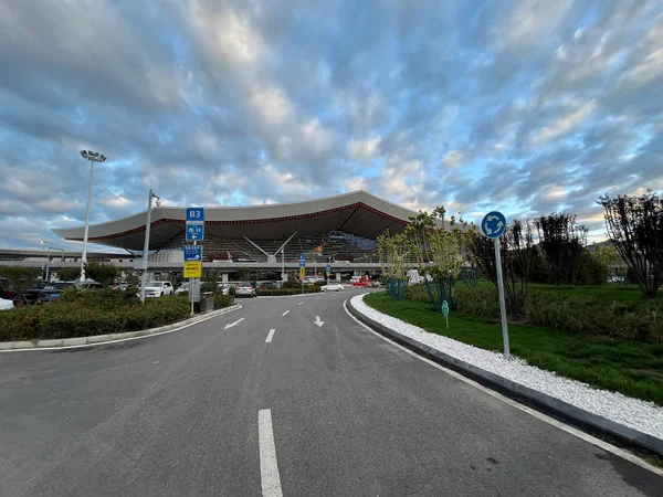
Lhasa Gonggar International Airport (LXA) stands in Gonggar County beside the Yarlung Tsangpo, roughly an hour or more by road from central Lhasa depending on traffic. It sits around 3,570 metres, so arrival day should be deliberately light: hydrate normally, avoid alcohol and strenuous sightseeing, and do not ascend farther if headache, nausea, unusual fatigue or dizziness develops. Current terminal, transfer and flight details must be checked with the airport and carrier.

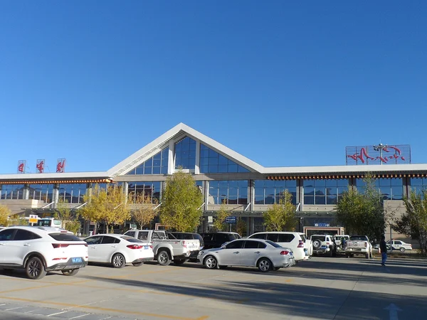
Lhasa Gonggar International Airport terminal and plateau surroundings
 

English name
Lhasa Gonggar International Airport
Chinese name
拉萨贡嘎国际机场
Location
Gonggar County, Shannan; ground transfer to Lhasa required
Approximate elevation
3,570 m
Flight area class
4E in published civil-aviation records
IATA code
LXA
ICAO code
ZULS

Chamdo Bangda Airport: Eastern Tibet Access

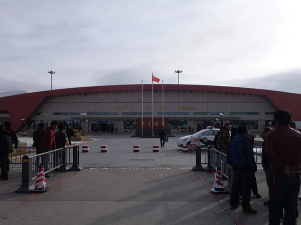
Chamdo Bangda Airport (BPX) serves eastern Tibet from a very high plateau site. Long runways at high-elevation airports compensate for reduced air density; they are not a tourist record or evidence that operations are easy. Weather can disrupt flights and the road transfer to Chamdo is substantial, so do not schedule a tight same-day connection or important appointment.

Chamdo Bangda Airport runway on the high plateau
 

English Name:
Chamdo Bangda Airport
Chinese Name:
昌都邦达机场
Location:
Bangda area, Qamdo/Chamdo
Average Elevation:
4,330 m
IATA:
BPX
ICAO:
ZUBD
Route check
Verify the current city pair and operating day with the airline
Ground transfer
Pre-arranged vehicle and generous contingency time recommended
Civil operation
Opened in the 1990s; facilities and procedures have since changed


Nyingchi Mainling Airport: Lower-Altitude Entry

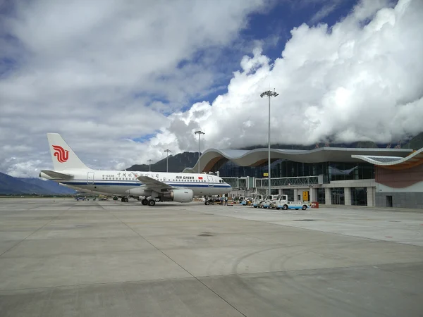
Nyingchi Mainling Airport (LZY) lies in the Yarlung Tsangpo valley at about 2,949 metres. It is lower than Tibet's other principal airports but is still high enough for altitude illness. Mountain weather and valley approaches can affect operations. Travelers continuing by road to Lhasa gain elevation, so the transfer should be paced rather than marketed as a guaranteed cure for acclimatization.

Nyingchi Mainling Airport in the Yarlung Tsangpo valley
 

English Name:
Nyingchi Mainling Airport
Chinese Name:
林芝米林机场
Location:
Mainling, Nyingchi; road transfer to Bayi/Nyingchi city
Average Elevation:
2,949 m
IATA:
LZY
ICAO:
ZUNZ
Runway context
High-altitude valley airport; operational data should be rechecked
Planning value
Useful for southeastern Tibet when flight and permit plans align
 

Ngari Gunsa Airport: Remote Western Gateway

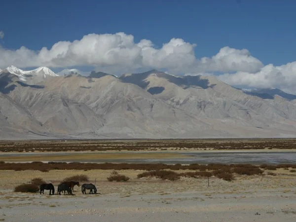
Ngari Gunsa Airport (NGQ) serves the Ali/Ngari region near Shiquanhe at roughly 4,274 metres. Flying directly here creates an abrupt altitude gain and places the traveler far from major medical services. A qualified pre-travel health discussion, conservative arrival plan and reliable ground support are more important than saving a day in transit. Mount Kailash routes also require separate access arrangements.
Gar Tsangpo plateau landscape near Ngari Gunsa Airport
English Name:
Ngari Gunsa Airport
Chinese Name:
阿里昆莎机场
Location:
Near Shiquanhe/Sênggê Zangbo in Ngari
Average Elevation:
4,274 m
IATA code
NGQ
ICAO code ZUAL
Runway
Approximately 4,500 m; verify current published data


Shigatse Peace Airport: Central-Western Access

Shigatse Peace Airport (RKZ) is a civil-military airport outside Shigatse at roughly 3,800 metres. Civil schedules can be limited and photography rules may be stricter than at an ordinary terminal. Build the itinerary around a verified flight rather than assuming daily service, and allow acclimatization before travel toward higher western areas or Everest-region routes.

Shigatse Peace Airport runway and mountain setting
 

English Name:
Shigatse Peace Airport
Chinese Name:
日喀则和平机场
Location:
Jiangdang area outside Shigatse
Average Elevation:
About 3,800 m
IATA code
RKZ
ICAO code
ZURK
Schedule rule Confirm directly; do not rely on an undated route list
Runway and arrival
Keep the first day light at this long, high-altitude dual-use airport. Coordinate the required Tibet travel permits before ticketing, and compare Tibet's tourist regions and cities to choose the gateway that logically fits the route.

Editorial accountability

How this guide is checked

Named content owner

Hu Lei, CEO. The named owner is responsible for travel-planning accuracy and escalation of time-sensitive checks.

Company and licence status

Yuntian Travel (Yunnan) Group is identified in its corporate profile as a licensed professional inbound travel service provider based in Kunming, China. Registration and travel-service documents can be requested before booking.

Source basis

Page-specific references where cited, official destination, transport and entry notices, YUNSKY route-planning records, and direct provider confirmation before a booking is finalized.

Update basis

Content is reviewed when rules, transport, access, pricing or route conditions change. Final availability and operating details are reconfirmed for each traveler’s dates.

Quality review: Page updated:

Open WhatsApp chat with YunSky Travel