Your China & Yunnan Travel Experts


Qinghai–Tibet Railway Project: Engineering and Timeline

 
The Qinghai–Tibet Railway connects Xining in Qinghai with Lhasa in Tibet across high-altitude permafrost and protected ecosystems. Its history is best understood as two construction phases plus decades of survey, monitoring and later extensions.
 
The approximately 1,956-kilometre Xining–Lhasa route includes the earlier Xining–Golmud section, completed in 1984, and the 1,142-kilometre Golmud–Lhasa section opened on July 1, 2006. The construction history should not be confused with a live timetable; use the Qinghai–Tibet Railway overview for route planning. Reviewed August 29, 2026.
 
Through passenger services can originate in several cities, but train numbers, operating days, boarding stations and stop patterns change. Engineering history does not guarantee today's service.
 

Project Facts and How to Interpret Them
 

English name
Qinghai–Tibet Railway
Chinese name
青藏铁路
Core regions
Qinghai and Tibet Autonomous Region
Terrain
Plateau basins, mountains, permafrost and river headwaters
Climate constraints
Cold, low oxygen, wind, intense ultraviolet radiation and large temperature range
Main passenger hubs
Xining, Golmud, Nagqu and Lhasa; exact stops depend on the train
Route length
Approximately 1,956 km
Journey time
Varies by service and date; verify the current official timetable
 

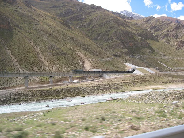
Qinghai Tibet Railway crossing high plateau terrain
 
► The track reaches about 5,072 metres near Tanggula. Elevation figures describe infrastructure, not a safe place for an unscheduled passenger stop.
 
► Fenghuoshan Tunnel was a landmark high-permafrost tunnel when the line opened. Promotional “world's highest” wording should be dated.
 
► Yangbajing Tunnel is one of the important structures on the approach to Lhasa; exact record claims change as new railways open.
 
► Long stretches exceed 4,000 metres, requiring plateau-adapted rolling stock, operating procedures and health preparation. Oxygen outlets support comfort and emergency response but do not remove the risk of acute altitude illness. Travelers should keep prescribed medicines accessible, drink normally, avoid alcohol and tell train staff promptly if symptoms become severe.
 
► Bridges, embankment treatments, ventilation or cooling systems and continuous monitoring address permafrost settlement and drainage. These methods are location-specific: rock, seasonal frozen soil, ice-rich permafrost, wetlands and river crossings require different foundations and maintenance. A record set at opening does not prove that every structure still holds the same superlative today.
 
► Wildlife passages and elevated sections reduce habitat fragmentation, but construction and climate effects still require long-term observation. Passengers should observe animals through the window rather than expecting a wildlife stop; sightings vary with season, distance, weather and train speed. Compare the landscapes in the railway scenery guide.
 

Milestones and Continuing Responsibilities

1950s–1970s
Route surveys, design studies and phased national planning across extremely difficult terrain.
1970s
Construction advanced on the lower Xining–Golmud section.
1984
The Xining–Golmud phase entered operation.
1990s
Further feasibility, permafrost, environmental and engineering study for the Golmud–Lhasa phase.
2001
Construction of the Golmud–Lhasa section formally began.
2001–2006
Track, bridges, tunnels, stations, power, communications and environmental mitigation were completed and tested.
July 1, 2006
The Golmud–Lhasa section opened for service.
After 2006
Monitoring, maintenance and regional extensions continued. Permafrost is not a solved problem: warming and changing moisture can affect ground stability, while rail access changes settlement and tourism patterns. Maintenance teams therefore track settlement, temperature, drainage, bridge condition and track geometry rather than relying only on the original design assumptions. Environmental performance likewise requires repeated observation of wildlife movement, wetlands, waste and visitor pressure. The route also crosses major headwater systems described in the rivers of Tibet guide.

Open WhatsApp chat with YunSky Travel