China's drylands are not one endless sea of sand. They include lake-filled mega-dunes, shifting sand seas, semi-fixed dunes with spring flowers, a compact oasis beside Dunhuang and a Yellow River landscape shaped by decades of sand control. This is an editorial shortlist, not an official national ranking. Use it to compare scenery and logistics, then place each landscape within the country's much wider
geography. Desert weather, road access and protected-area rules can change quickly, so confirm local conditions shortly before departure.
1. Badain Jaran Desert: Mega-Dunes and Lakes
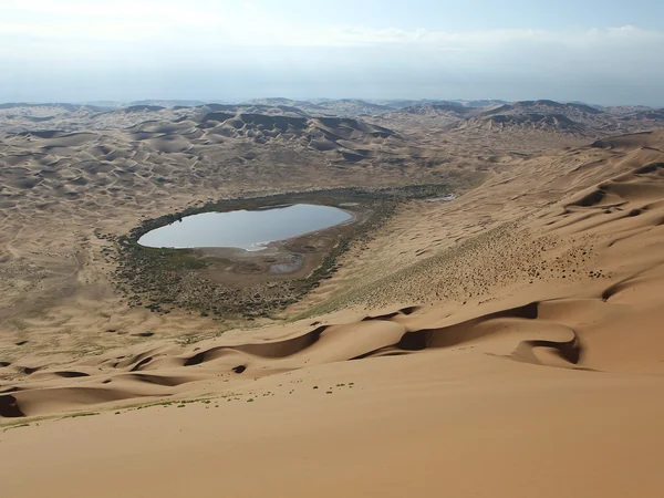
In western Inner Mongolia's Alxa region, Badain Jaran is the choice for travellers who want scale rather than a quick roadside photo. UNESCO inscribed the “Towers of Sand and Lakes” property in 2024 for its exceptional concentration of stabilized mega-dunes, interdunal lakes and continuing desert processes. The World Heritage property is a defined protected area within the desert, not a label for every dune in Alxa.
What sets it apart is the relationship between
towering sand and saline lakes: some 144 interdunal lakes occur in the inscribed property, while the tallest stabilized mega-dunes reach about 460 metres in relative relief. Multi-day access commonly involves long transfers and rough desert tracks; independent route improvisation is a poor idea. Build the visit through an experienced local operator, carry sun and wind protection, and follow the current conservation rules. Our
Inner Mongolia guide helps place Alxa within a longer regional route.
2. Taklimakan Desert: A Sand Sea on the Silk Road
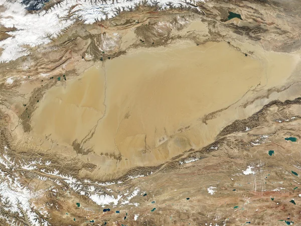
The Taklimakan occupies most of the Tarim Basin in southern Xinjiang. Its appeal is geographic: enormous dune fields sit between oasis towns that once linked the southern and northern routes of the Silk Road. A desert highway crossing can reveal that scale, but the journey is measured in hours rather than one scenic stop. Calling it China's “driest and highest” desert oversimplifies a complex basin; the more useful distinction is that it is the country's largest desert.
Choose an approach from a real itinerary—Kashgar, Hotan, Aksu or Korla—rather than adding “the Taklimakan” as a vague day trip. Fuel range, permitted routes, sandstorms and extreme temperature swings matter. The state reported in 2024 that a 3,046-kilometre sand-blocking green belt had closed around the desert; that ecological project should not be mistaken for a continuous tourist road or unrestricted access.
For historical context, connect an oasis stop with the broader Silk Road route. For scenery, early or late light gives dunes shape; at midday the relief can flatten and heat becomes the main story. Never leave the road or a licensed excursion route simply to chase an empty horizon.
3. Gurbantunggut Desert: Dunes with Seasonal Life
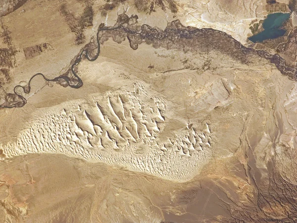
Gurbantunggut is the large desert of the Junggar Basin in northern Xinjiang. Much of its surface is fixed or semi-fixed rather than continuously shifting, so shrubs and spring ephemerals can soften the familiar “barren desert” image. That vegetation is fragile: a green-looking patch is habitat, not an invitation to drive over it. This landscape works best for travellers already moving between Urumqi, northern Xinjiang and designated desert or geopark sites. Exact flowering periods depend on winter moisture and spring temperature, and access roads vary by locality. Ask which named site the tour actually enters, how much walking is involved and whether a permit or local vehicle is required; “Gurbantunggut tour” alone is not a sufficiently precise booking description.
4. Mingsha Hill and Crescent Spring: Dunhuang's Easy Desert Encounter
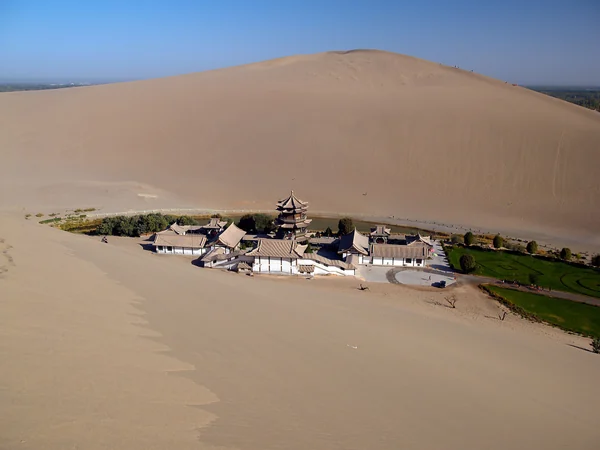
Mingsha Hill rises immediately beside
the oasis city rather than deep in a roadless desert. That proximity makes it the easiest selection here for a first-time visitor. The managed scenic area combines high dunes, marked visitor routes and
Dunhuang access; it is commonly paired with the Mogao Caves, although the two are separate attractions with separate reservations and very different heritage values.
Crescent Spring sits below the dunes as a small oasis pool whose shape is best understood from above. Arrive near opening or later in the day for lower temperatures and more textured light, but check the current last-entry time rather than relying on an old blog. Camel rides and sand activities follow managed routes. Keep water, a face covering for windblown sand and a sealed bag for cameras; do not walk onto restoration or closed dune areas for a cleaner photograph.
5. Shapotou: Where Desert Meets the Yellow River
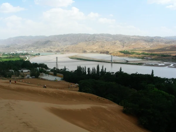
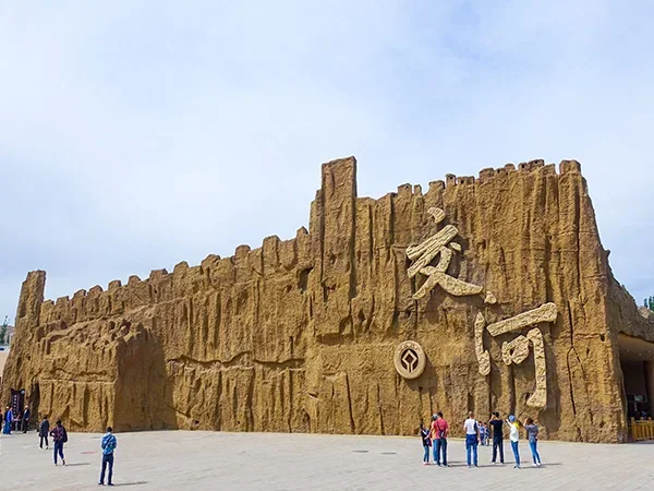
Shapotou in Zhongwei, Ningxia, is not a separate desert named “Shapotou Desert.” It is a scenic and conservation landscape on the southeastern edge of the Tengger Desert, where dunes, the Yellow River, irrigated land and railway sand-control works meet. That combination—not raw wilderness—is the reason to come. Ningxia's official tourism information lists the area as a national 5A attraction, but opening periods, bundled activities and transport charges remain operational details to verify directly.
Families and short-stay travellers may find Shapotou more approachable than Badain Jaran or a Taklimakan crossing. Sand sliding, river views and managed desert activities can fill a day, while Zhongwei adds hotels and rail or air connections. The grass-grid sand barriers beside the Baotou–Lanzhou railway are also a reminder that this is a long-running ecological-management story. Stay on marked routes, avoid trampling restoration plots and decide in advance whether the priority is landscape photography, family activities or the history of sand control.