Your China & Yunnan Travel Experts



China's western mountain systems include Himalayan and Karakoram summits on international borders, peaks wholly within China and extensive ranges whose highest points are debated across older maps. This page preserves 14 familiar names from the original guide but no longer presents them as a definitive national “top 14.” A strict ranking changes with the definition of a separate peak, border inclusion and the elevation dataset. Start with the wider geography of China, then read the list as an orientation to landscapes and viewpoints. How to read the elevations: Everest uses the 8,848.86-metre snow-surface height jointly announced by China and Nepal in 2020. The standard eight-thousander names follow the UIAA list. For lower peaks, official Chinese surveys are used where available; elsewhere figures are rounded and uncertainty is stated rather than hidden. A mountain viewpoint, a high-altitude trek and an expedition permit are three different products. Nothing below should be treated as climbing instruction.
Official snow-surface elevation: 8,848.86 metres. China and Nepal jointly announced that figure after coordinated surveys, replacing the conflicting rounded numbers still copied by many older pages. The summit stands on the China–Nepal boundary,
and is the world's highest point above sea level.
Qomolangma is the standard Chinese and Tibetan name used on the north side.
Planning note: a normal Tibet trip may include an authorized base-camp-area viewpoint,
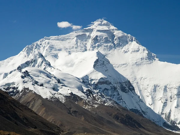
but altitude acclimatization, current permits, road controls and overnight arrangements must be confirmed through current official and licensed channels. Expedition camps and the summit are not visitor attractions.
K2 is the world's second-highest mountain and the highest summit of the Karakoram. Its Chinese name is commonly rendered Qogir or Qiaogeli. The summit lies on the China–Pakistan boundary in an exceptionally remote landscape. Ordinary sightseeing routes do not reach the climbing approaches; photographs from Pakistan and China also show different faces. Treat any K2 itinerary as a specialist expedition or long wilderness journey with separate permissions, logistics and risk management.
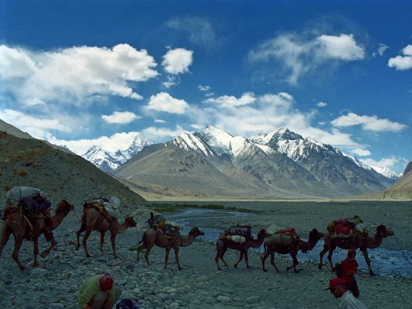
K2 seen from the Karakoram high country
Lhotse shares the South Col system with Everest and is recognized by the UIAA as the world's fourth-highest main summit. Its eastern side faces Tibet, while the standard expedition story is often told from Nepal. That distinction matters: a generic “China view of Lhotse” should identify the actual viewpoint rather than borrow a caption from the opposite side.

Lhotse's steep south face and close relationship with Everest make it important in mountaineering history, but it is not a casual add-on from Everest Base Camp. Visitors should focus on the broader Himalayan panorama and leave route descriptions to qualified expedition authorities.
Makalu is a sharply pyramidal eight-thousander on the China–Nepal boundary, southeast of Everest. Its isolation in photographs can be deceptive: the mountain is surrounded by complex ridges, glaciers and protected terrain. Standard world rankings place it fifth by elevation.

For a travel page, the honest advice is simple. Makalu is chiefly a remote-mountain and expedition subject, not a named stop on a normal Lhasa–Everest itinerary. Any promised viewpoint should be checked against a map, season and road access.
Cho Oyu stands west of Everest on the China–Nepal boundary and is the sixth-highest main summit on the standard UIAA list. The nearby Nangpa La has long connected landscapes and communities across the Himalaya, but modern border and reserve controls determine access.

Descriptions that call Cho Oyu an “easy eight-thousander” are irresponsible. That phrase only compares technical routes among extreme-altitude expeditions; avalanche, weather, altitude illness and rescue limits remain life-threatening. Non-climbers should seek a licensed distant viewpoint rather than an expedition product.
Broad Peak belongs to the Karakoram and stands on the China–Pakistan boundary near K2. The UIAA recognizes it as one of the 14 main eight-thousanders and places it twelfth by elevation. It is not part of the Kunlun Mountains, an error repeated in the former page.
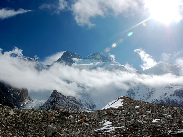
Its broad summit ridge explains the English name, but the mountain has several tops and should not be reduced to one postcard profile. As with K2, a normal China sightseeing itinerary does not provide straightforward public access to the expedition landscape.
Shishapangma is the only one of the 14 universally recognized eight-thousanders whose main summit lies wholly within China. It stands in Tibet's Jugal Himal and is the lowest of that group by elevation. The alternate spelling Xixabangma appears in older English travel material.
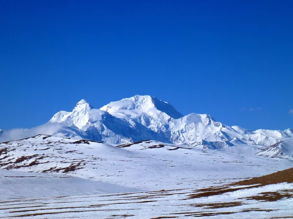
Its all-China location does not make access simple. Reserve rules, expedition authorization and road conditions apply, and distant road views should not be marketed as a base-camp trek unless the exact licensed programme supports that claim.
Gyachung Kang stands on the China–Nepal boundary between Cho Oyu and Everest. It is widely described as the highest peak below 8,000 metres, although older references differ on the precise elevation and on subsidiary-summit treatment.
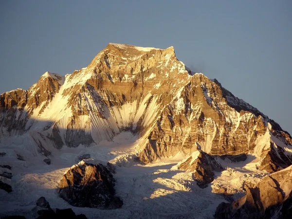
That near-eight-thousand-metre status makes it useful for understanding how an arbitrary threshold shapes fame: Gyachung Kang is less known than every eight-thousander despite being higher than most mountains on Earth. It remains an expedition-scale peak, not a routine viewpoint.
Namcha Barwa also written Namjagbarwa, rises above the great bend of the Yarlung Tsangpo in southeastern Tibet. Elevations around 7,782 metres are common in modern references; the former 7,785-metre figure should be treated as an older rounded value rather than a separate summit. The mountain's value to most travellers is visual and geographic. It anchors a huge transition from high plateau to deep forested canyon, yet cloud often conceals the summit. Nyingchi-area viewpoints and villages offer realistic chances to see the massif; the inner gorge is not an open self-guided shortcut.
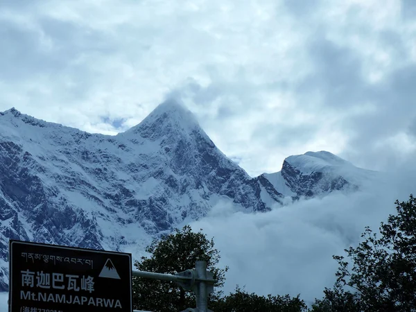
Namcha Barwa above the Yarlung Tsangpo region
Mount Gongga also known as Minya Konka, is the highest mountain in Sichuan. A 2023 elevation announcement approved by China's State Council gives 7,508.9 metres, superseding the long-repeated 7,556-metre value. That correction changes numbers, not the mountain's extraordinary relief above the eastern edge of the Tibetan Plateau. For travellers, Gongga is one of the most rewarding entries on this page because several lower valleys and passes offer distant views. Conditions still vary sharply with season, and high passes require sound acclimatization and local route advice. Choose established viewing areas or a properly supported trek; the summit itself is exceptionally serious terrain. A broader China nature route can pair the massif with western Sichuan without pretending every visitor is a climber.
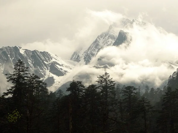
Mount Gongga rising above western Sichuan
Buka Daban is a name used for a remote high peak in the Kunlun region near the Xinjiang–Qinghai boundary. Older English and Chinese maps attach several transliterations and elevations—often around 6,860 metres—to nearby summits. That inconsistency makes a confident “highest point of Qinghai” label unsafe without a named official survey point.
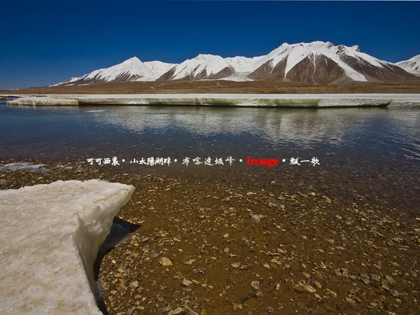
For trip planning, the key fact is remoteness. The central Kunlun is a research and expedition landscape with vast distances, limited services and sensitive protected areas. It should not be sold as a normal scenic stop on the basis of one catalogue number.
At 6,740 metres, Kawagebo —also written Khawa Karpo— is the highest summit of the Meili Snow Mountains in northwestern Yunnan. UNESCO's Three Parallel Rivers documentation identifies the glaciated Meili range as part of the property's outstanding skyline and gives the same elevation. Kawagebo is also sacred to Tibetan Buddhist communities; it should not be framed merely as an unclimbed trophy. Feilai Temple and other authorized roadside viewpoints near Deqin provide the classic sunrise panorama when clouds clear. Respect prayer activity, avoid drones where prohibited and do not cross closed glacier or pilgrimage routes. Weather is the deciding factor, so allow more than one dawn if the mountain matters to the journey.

Kawagebo in the Meili Snow Mountains
Mount Kailash is far more important as a sacred mountain than as an elevation statistic. Known as Gang Rinpoche in Tibetan, it is revered in Buddhist, Hindu, Jain and Bön traditions. The summit is not a climbing objective, and responsible travel language should never imply that it is open for ascent.

Pilgrims undertake a high-altitude circuit around the mountain, while other visitors use distant viewpoints. The route is physically demanding and reaches a very high pass; acclimatization, current Tibet travel authorization, local weather and individual health all require professional review. Observe pilgrimage etiquette and never treat worshippers as staged photo subjects.
The Qilian Mountains form a long highland boundary between Gansu and Qinghai. The old claim that “Tuanjie Peak” reaches 6,644 metres is not supported by current standard topographic references and likely conflates peaks or datasets. The range's highest summits are generally mapped at roughly 5,800 metres, but exact naming varies; this page therefore avoids inventing a single definitive figure.
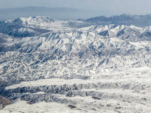
For travellers, Qilian is more accessible as a range of glaciers, grasslands, valleys and distant snowy ridges than as a summit quest. Menyuan, Zhangye-side corridors and parts of Haibei reveal different faces, with seasonal road and reserve rules. The larger lesson from all 14 entries is to choose a verified viewpoint and suitable altitude, not a headline rank.

Editorial accountability
Hu Lei, CEO. The named owner is responsible for travel-planning accuracy and escalation of time-sensitive checks.
Yuntian Travel (Yunnan) Group is identified in its corporate profile as a licensed professional inbound travel service provider based in Kunming, China. Registration and travel-service documents can be requested before booking.
Page-specific references where cited, official destination, transport and entry notices, YUNSKY route-planning records, and direct provider confirmation before a booking is finalized.
Content is reviewed when rules, transport, access, pricing or route conditions change. Final availability and operating details are reconfirmed for each traveler’s dates.
Quality review: Page updated: