The Taklamakan—also spelled Taklimakan—occupies much of the Tarim Basin in Xinjiang and is China's largest and driest desert. Mountain ranges isolate the basin from major moisture sources, while mobile dunes cover most of the desert surface. That geography explains both the dramatic landscape and the serious planning limits: dust, temperature swings, sparse services and very long road distances. The historical Silk Road generally followed oasis corridors around the desert rather than crossing its center casually. Modern highways now traverse parts of the basin, but a traveler still needs a legal route, a reliable vehicle, current road and weather information, and realistic emergency support. The sections below retain the original order while replacing sensational legends and unsafe crossing advice with landscape context, archaeology ethics and practical decision-making. Continue with the
Xinjiang destination guide when this landscape fits the wider route.
Xinjiang
A practical visit to Taklamakan Desert Travel Guide: China's Largest Desert depends on realistic sequencing. Most visitor journeys use established highways and oasis towns. Dust, wind, heat, winter cold and dryness are central planning factors. Keep enough margin for weather, transfers and a change of plan. Around Taklamakan Desert Travel Guide: China's Largest Desert, base the day on an established highway, oasis or managed viewing area. Calculate fuel, water, daylight, dust and communications margins before leaving the last service town; historic ruins and desert ecology also require lawful entry and a strict no-collection, no-off-road approach.
Size and Geography of the Taklamakan
Climate: Dryness, Dust and Temperature Range
Taklimakan Desert For responsible landscape travel at Climate: Dryness, Dust and Temperature Range, use the established visitor route and understand what the place represents. NASA describes parts of the Tarim Basin as receiving very little annual precipitation, while passing systems can drive major dust events across the basin. Water, sun protection, layers and a dust plan are safety necessities rather than optional comfort items. Choose season and daily timing around heat tolerance, daylight and road reliability. Around Climate: Dryness, Dust and Temperature Range, base the day on an established highway, oasis or managed viewing area. Calculate fuel, water, daylight, dust and communications margins before leaving the last service town; historic ruins and desert ecology also require lawful entry and a strict no-collection, no-off-road approach.
The strongest reason to include Climate: Dryness, Dust and Temperature Range is its specific regional context. NASA describes parts of the Tarim Basin as receiving very little annual precipitation, while passing systems can drive major dust events across the basin. Check current forecasts and road notices before every long sector, not only before leaving the first city. Compare that commitment with other stops before adding another long transfer. Around Climate: Dryness, Dust and Temperature Range, base the day on an established highway, oasis or managed viewing area. Calculate fuel, water, daylight, dust and communications margins before leaving the last service town; historic ruins and desert ecology also require lawful entry and a strict no-collection, no-off-road approach.
Mobile Sand Dunes
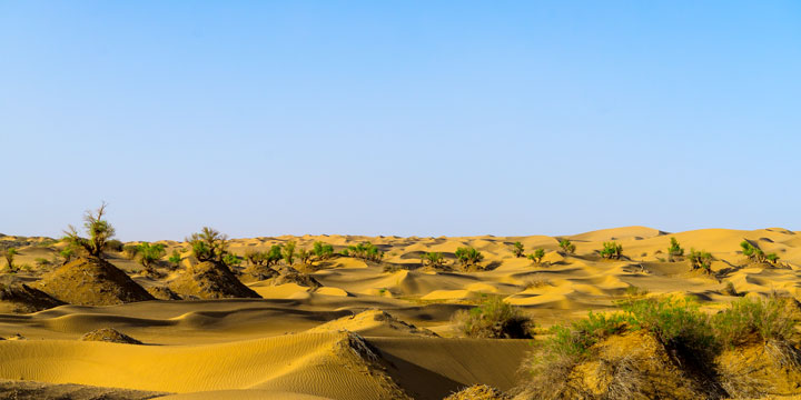
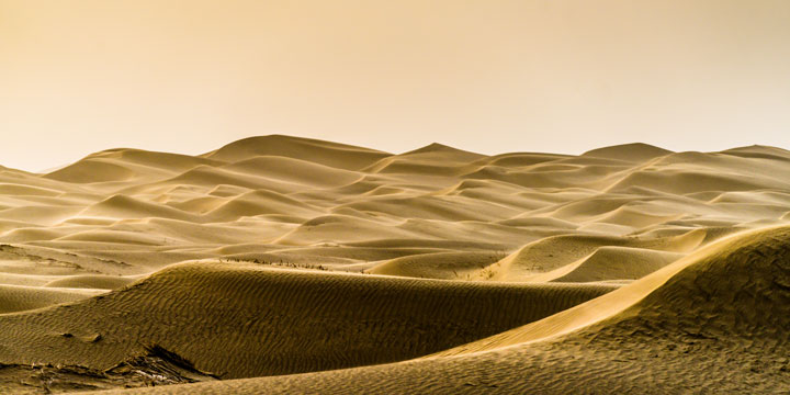
Mobile dunes cover a large majority of the Taklamakan and can reach substantial heights, creating the desert's rolling horizon and frequent dust movement. View dunes from lawful road, park or guided-access locations instead of driving onto unmarked sand. This distinction is central to choosing Mobile Sand Dunes within a wider Taklamakan Desert travel guide itinerary. Walking distance is deceptive in soft sand; protect camera equipment without sealing it in a way that traps heat. Around Mobile Sand Dunes, base the day on an established highway, oasis or managed viewing area. Calculate fuel, water, daylight, dust and communications margins before leaving the last service town; historic ruins and desert ecology also require lawful entry and a strict no-collection, no-off-road approach.
Oases and the Silk Road
Conditions shape the experience at Oases and the Silk Road. River flow, agriculture, heat and dust create seasonal variation in oasis landscapes. Road and rail connections follow long arcs around or across parts of the basin; calculate realistic transfer days. Recheck current forecasts, tickets and operating notices shortly before travel. Around Oases and the Silk Road, base the day on an established highway, oasis or managed viewing area. Calculate fuel, water, daylight, dust and communications margins before leaving the last service town; historic ruins and desert ecology also require lawful entry and a strict no-collection, no-off-road approach. Continue planning with the
Silk Road travel guide.
Traveler fit matters more than a superlative at Oases and the Silk Road. Use Kashgar, Yarkand, Hotan, Niya-region heritage, Kuqa or Turpan according to the chosen corridor. River flow, agriculture, heat and dust create seasonal variation in oasis landscapes. Historic ruined sites may have protected access and fragile archaeology, so confirm legal entry and stay on marked routes. Around Oases and the Silk Road, base the day on an established highway, oasis or managed viewing area. Calculate fuel, water, daylight, dust and communications margins before leaving the last service town; historic ruins and desert ecology also require lawful entry and a strict no-collection, no-off-road approach.
Wildlife and Vegetation at the Desert Margins
A practical visit to Mobile Sand Dunes depends on realistic sequencing. A suitable vehicle, experienced driver and communications plan are essential for any permitted route away from major roads. Wind reshapes the surface and can erase vehicle tracks or reduce visibility quickly. Keep enough margin for weather, transfers and a change of plan. Around Mobile Sand Dunes, base the day on an established highway, oasis or managed viewing area. Calculate fuel, water, daylight, dust and communications margins before leaving the last service town; historic ruins and desert ecology also require lawful entry and a strict no-collection, no-off-road approach.
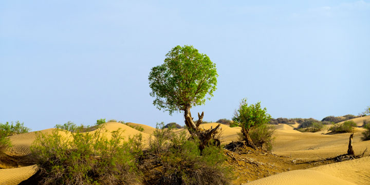
For responsible landscape travel at Wildlife and Vegetation at the Desert Margins, use the established visitor route and understand what the place represents. Life is concentrated around river corridors, dune depressions and desert margins where poplar, tamarisk, reeds and drought-adapted shrubs can persist. Do not approach wildlife, remove plants, leave food or promote driving through fragile riparian habitat. Treat wildlife as an ecological possibility, not a promised attraction. Around Wildlife and Vegetation at the Desert Margins, base the day on an established highway, oasis or managed viewing area. Calculate fuel, water, daylight, dust and communications margins before leaving the last service town; historic ruins and desert ecology also require lawful entry and a strict no-collection, no-off-road approach.
The strongest reason to include Wildlife and Vegetation at the Desert Margins is its specific regional context. Life is concentrated around river corridors, dune depressions and desert margins where poplar, tamarisk, reeds and drought-adapted shrubs can persist. Use protected-area or locally interpreted sites if ecology is a main interest. Compare that commitment with other stops before adding another long transfer. Around Wildlife and Vegetation at the Desert Margins, base the day on an established highway, oasis or managed viewing area. Calculate fuel, water, daylight, dust and communications margins before leaving the last service town; historic ruins and desert ecology also require lawful entry and a strict no-collection, no-off-road approach.
Archaeology, Mummies and Desert Legends
The Tarim Basin preserves important archaeological sites and human remains because aridity can slow decay, but discoveries belong to scientific and museum contexts. Visit recognized museums and authorized sites rather than searching the desert for objects. This distinction is central to choosing Archaeology, Mummies and Desert Legends within a wider Taklamakan Desert travel guide itinerary. Never collect pottery, textiles, bones or other material; report a find to the relevant authorities. Around Archaeology, Mummies and Desert Legends, base the day on an established highway, oasis or managed viewing area. Calculate fuel, water, daylight, dust and communications margins before leaving the last service town; historic ruins and desert ecology also require lawful entry and a strict no-collection, no-off-road approach. Continue planning with the Silk Road tour route. Taklimakan Desert
Route planning for Archaeology, Mummies and Desert Legends should begin with purpose and travel time. Xinjiang museums and documented Silk Road sites provide safer context than unsupported treasure stories. Visit recognized museums and authorized sites rather than searching the desert for objects. Never collect pottery, textiles, bones or other material; report a find to the relevant authorities. Around Archaeology, Mummies and Desert Legends, base the day on an established highway, oasis or managed viewing area. Calculate fuel, water, daylight, dust and communications margins before leaving the last service town; historic ruins and desert ecology also require lawful entry and a strict no-collection, no-off-road approach.
Practical Tips for a Taklamakan Desert Trip