Your China & Yunnan Travel Experts


Mount Huangshan photography guide —reviewed August 28, 2026—treats the Mount Huangshan scenic area as a protected vertical landscape whose trail, cableway, lodging and weather decisions determine every dawn or sunset frame. Mount Huangshan , also called Yellow Mountain , is a mixed cultural and natural World Heritage property in Anhui, inscribed in 1990 and known for granite peaks, old pines, cloud and mist. UNESCO records a 16,060-hectare property and a 49,000-hectare buffer zone. Those facts explain its significance; they do not guarantee a “sea of clouds,” unrestricted viewpoints or a fixed route. Current official notices require real-name, timed and direction-specific reservations and can change gate, shuttle, cableway and peak access. Build the photograph around a legal route and conservation rules, not around an old list of superlatives.
Sunrise and sunset are conditional mountain events. The summit zone involves steep stone steps, exposed edges, darkness, cold, wind and large elevation changes; a viewpoint that looks close on a stylized map may still require a demanding walk. Choose lodging and one primary viewpoint together, scout in daylight, save a safe fallback and set a turnaround time. photography planning starts with the official forecast and operating notice, not a copied seasonal timetable.
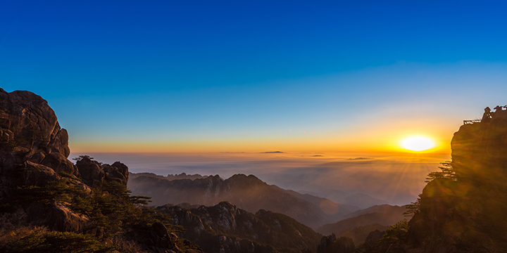
Dawn light over granite peaks and cloud layers at Mount Huangshan
Bright Summit, the Beihai area, Danxia Peak and other signed platforms can face useful dawn sectors, but current path access, tree growth, crowd control and the sun's date-specific azimuth matter more than a seasonal “best” list. Ask the hotel or scenic-area staff which nearby public platform is open, walk the approach before dark, and keep a second lower-risk position. Do not leave a marked path, climb a rock or cross a barrier to clear another tripod from the frame.

Sunrise above Mount Huangshan's granite ridges
The old seasonal clock ranges on this page were approximate and can be wrong by many minutes. Use the scenic area's dated weather bulletin or a reliable astronomical calculator for the exact coordinates, then add twilight, ridge obstruction and walking time. A forecasted “visible probability” is still a probability, not a promise. Confirm the platform opening and route the evening before and again on departure.
Summit lodging changes name, operation, room inventory and nearest open route over time. Book from a current official or verified channel, save the hotel's Chinese name and pin, and ask in writing which signed dawn platform is realistically reachable for your pace. “Ten minutes” in an older guide may exclude stairs, darkness, queues, snow or a path closure. Confirm breakfast, luggage, heating, check-out, cancellation and whether staff issue a morning weather notice.
Beihai-area lodging can reduce the walk to nearby northern platforms, but Lion Peak or a named pavilion may be closed or crowd-managed. Ask for today's route rather than relying on a historic walking estimate.
Xihai or Paiyun-area lodging can suit Danxia and western light, yet the West Sea Canyon and connecting paths operate seasonally. Do not build a dawn or sunset exit through a section that has not been confirmed open.
Baiyun-area lodging may suit Bright Summit and central transfers. The broad junction is popular; identify where tripods are allowed and choose a signed lower platform when crowd density makes the edge unsafe.
Yuping-area lodging may fit southern approaches and Jade Screen subjects, but cableway hours do not normally solve a pre-sunrise ascent. The overnight route and the next day's descent must both be feasible.
If a hotel named in an old article cannot be found on a current official map or booking record, treat it as obsolete rather than assuming a renamed property.

Orientation map of Mount Huangshan routes; verify every trail and facility against the current official map
Bright Summit, Danxia, Cloud-Dispelling Pavilion and other signed western exposures can work, but the strongest colour may arrive after the sun is hidden by a nearer ridge. Scout the return in daylight, keep a headlamp accessible and leave before the route becomes unsafe. Never reserve a narrow parapet with bags, and do not ask other visitors to remain still or move for a staged “empty mountain.” A cloud layer, silhouette or quiet blue-hour frame is a valid outcome when the solar disc never appears.
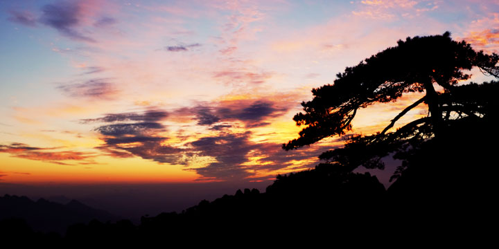
Sunset silhouette of a Huangshan pine and layered ridges
The page's former seasonal ranges included a reversed summer time and mixed 12-hour notation. Replace them with the actual date's official or astronomical sunset, then account for ridge shadow and twilight. Weather, cloud-base and platform orientation control what can be photographed. Save the time offline, but follow staff instructions if the scenic area closes a route early.
Bright Summit is a broad high point near major route junctions and can reveal cloud layers in several directions. It is not simply a guaranteed sunrise platform. Use a normal lens for route context and a short telephoto for layered peaks; protect highlights in cloud and keep enough depth of field for the intended foreground. Stay behind barriers and leave the circulation line open, especially when groups converge from multiple paths.
Lion Peak anchors the Beihai landscape, but named terraces and pavilions should be confirmed open before a pre-dawn plan. Photograph the relationship among pine, granite and cloud rather than isolating every rock as a landmark. A telephoto can compress ridges from a public platform, while a wider frame explains scale. Never step around a closure or climb a pine-rooted slope.
Danxia Peak can offer dawn or late-light structure from the western summit area. The route includes stairs and can be slippery or dark, so scout it, carry a light and turn back for ice or wind. Expose ochre rock without pushing colour beyond the reference frame. The view is valuable even without cloud; caption the actual weather rather than calling haze a sea of clouds.
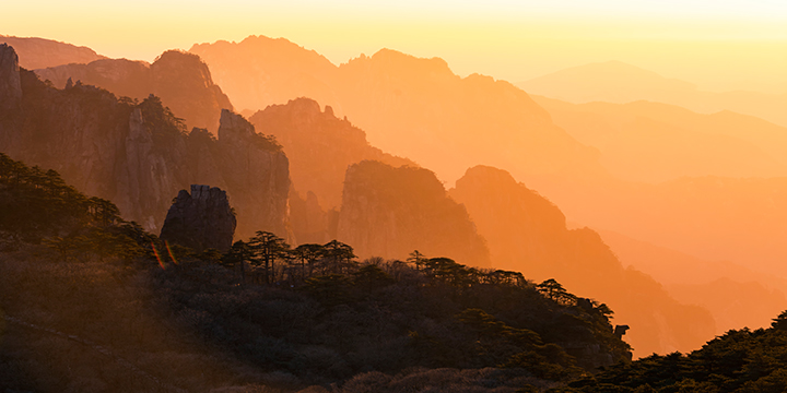
Warm light on Huangshan ridges near Danxia and the western summit area
Cloud-Dispelling Pavilion is an established viewpoint toward the West Sea formations. Use it to show scale and weather, but verify the pavilion and adjacent canyon paths separately: seeing one from the other does not mean every trail is open. Secure straps in wind, keep tripods compact and do not feed or approach wildlife. When fog removes the distant view, work with pine, railing rhythm and changing visibility instead of leaving the platform boundary.
Flying Rock is a prominent granitic formation on a signed summit route. Photograph it with surrounding rock or visitors at a respectful distance to communicate scale, but do not invent a geological mechanism from appearance. Use official interpretation for the caption, keep to the path and avoid a wide-angle position that requires leaning beyond a barrier.
Check the Huangshan Scenic Area management committee's dated forecast for temperature, wind, precipitation, sunrise/sunset and visibility probability, then check the operating announcement for gates, shuttles, cableways and peaks. Cloud and mist are core Huangshan subjects, so “sunny only” is poor advice. Stop for lightning, dangerous wind, icing, landslide warnings, staff evacuation or any closure; a dramatic forecast is not permission to remain exposed.
Arrive early enough to set up calmly, but do not claim a public railing with bags or tape. Keep one tripod footprint, allow people to pass and avoid extending legs toward an edge. Make a tested wide composition, one telephoto layer and one weather detail; this reduces frantic movement when light changes. If a platform is full, use a signed alternative instead of climbing, arguing or blocking stairs.

A signed Huangshan platform with space for safe shared viewing
Use layers that manage sweat, insulation, wind and rain; bring grippy footwear, headlamp, water, food, power bank, spare battery and a dry bag. Weather can be much colder than Huangshan City or Tangkou. Keep the kit light enough for sustained stairs and state mobility needs before booking. Step-free access is limited in the summit landscape; cableways reduce climbing but do not remove stairs, queues, exposure or weather closures.
Day 1: enter in the reserved direction, reach lodging with a daylight buffer, scout one sunset platform and its return, then confirm the next morning's forecast and route. Day 2: attempt one conditional sunrise, return for breakfast and reassess before adding a central or western subject. Back up files before descent. Use the Huangshan destination guide for gateway logistics and compare a realistic four-day Mount Huangshan itinerary before booking. Do not combine every named peak, West Sea Canyon and both cableway sides in one shoot; weather and vertical travel make that plan unsafe and visually repetitive.
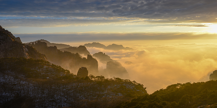
Build a Huangshan photography itinerary with current notices
From $ 1568
From $ 850
From $ 2583