China's grasslands range from low rolling steppe and river wetlands to high alpine pasture. “Most beautiful” is subjective, while color, flowers, grazing activity and road conditions change sharply by season. The six original regions are kept in order, but the useful comparison is now landscape type, gateway, altitude and the time needed to travel responsibly through working pastoral environments. Continue planning with the
forest landscapes in China.
1. Hulunbuir Grassland
For itinerary planning, It suits a multi-day road loop from Hailar rather than a single roadside photo stop. Distances between camps, towns and viewpoints are long. Summer is green but can be wet and insect-heavy; autumn is cooler and more golden. Ask before photographing residents, avoid staged cultural stereotypes and do not drive across unmarked pasture.
2. Ili Grasslands
The Ili region contains several distinct valleys and grasslands, including Nalati, Kalajun, Tangbula and Gongnaisi. The practical visitor decision is clear: Select one or two according to the wider Yining or Tianshan route. Current scenic shuttles, road access and travel documentation should be checked. Calling every Ili landscape one grassland hides large differences in distance and visitor management.
Conditions matter as much as scenery. Flowering, grazing and snowmelt timing varies by elevation. Current scenic shuttles, road access and travel documentation should be checked. The Ili region contains several distinct valleys and grasslands, including Nalati, Kalajun, Tangbula and Gongnaisi. Calling every Ili landscape one grassland hides large differences in distance and visitor management.
3. Xilingol Grassland
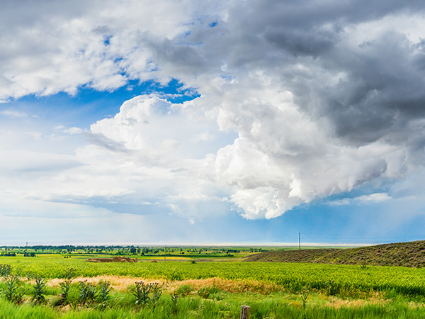
Use 3. Xilingol Grassland as a specific regional choice, not a checklist item. It fits travelers interested in open landscapes, pastoral land use and a less resort-like road journey. Wind, drought, rain and seasonal grazing alter color and ground conditions. Use Xilinhot as the gateway and choose lawful public routes. Avoid off-road shortcuts that damage grass cover and do not promise a festival without a current official schedule. Continue planning with the
Tibet travel planning.
Xilingol represents broad temperate steppe around Xilinhot and neighboring banners in Inner Mongolia. It fits travelers interested in open landscapes, pastoral land use and a less resort-like road journey. Wind, drought, rain and seasonal grazing alter color and ground conditions. Avoid off-road shortcuts that damage grass cover and do not promise a festival without a current official schedule.

4. Western Sichuan Highland Grasslands
For itinerary planning, They suit travelers already building an acclimatized Sichuan–Tibetan highland route. Kangding and regional towns act as staged bases; daily drives remain long. Altitude, ultraviolet exposure, rain, snow and landslides can be significant. Treat pastoral areas and religious landscapes as lived places, not empty scenery.
Western Sichuan grasslands sit among high valleys, monasteries and snow mountains in Garzê and neighboring areas. The practical visitor decision is clear: They suit travelers already building an acclimatized Sichuan–Tibetan highland route. Kangding and regional towns act as staged bases; daily drives remain long. Treat pastoral areas and religious landscapes as lived places, not empty scenery.
5. Nagqu Grassland
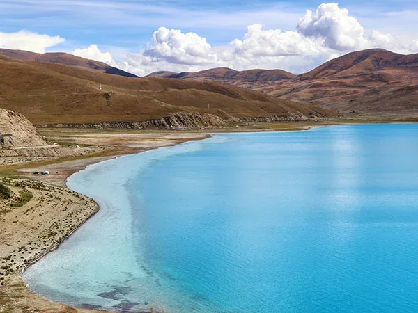
Conditions matter as much as scenery. Cold, wind, thin air and rapidly changing weather dominate planning. Authorized Tibet arrangements, acclimatization and verified road support are essential. Nagqu lies on the high northern Tibetan Plateau, with alpine steppe, wetlands and nomadic pastoral landscapes. Festival timing and visitor access can change; never publish an old August date as permanent.
Use How to Choose a Grassland Region as a specific regional choice, not a checklist item. Choose by route, culture and time available. Rain, insects, cold nights and road distances shape the trip. Use established roads and community-based visitor services. Respect livestock, fences and private or collectively managed grazing land.
6. Qilian Mountain Grasslands
The Qilian Mountains form a transition between the Hexi Corridor and high Qinghai landscapes, with mountain pasture, forest and snow peaks. They work well in a Zhangye–Qilian–Xining route when road time is realistic. High elevation, strong sun, summer rain and cold nights require layers. Treat protected habitat as a conservation landscape rather than unrestricted pasture access. Continue planning with the
nature reserves in China.
For itinerary planning, They work well in a Zhangye–Qilian–Xining route when road time is realistic. Choose a named county or scenic sector and verify the through-road condition. High elevation, strong sun, summer rain and cold nights require layers. Treat protected habitat as a conservation landscape rather than unrestricted pasture access. Qilian The Qilian Mountains form a transition between the Hexi Corridor and high Qinghai landscapes, with mountain pasture, forest and snow peaks. The practical visitor decision is clear: They work well in a Zhangye–Qilian–Xining route when road time is realistic. Choose a named county or scenic sector and verify the through-road condition. Treat protected habitat as a conservation landscape rather than unrestricted pasture access. Conditions matter as much as scenery. High elevation, strong sun, summer rain and cold nights require layers. Choose a named county or scenic sector and verify the through-road condition. The Qilian Mountains form a transition between the Hexi Corridor and high Qinghai landscapes, with mountain pasture, forest and snow peaks. Treat protected habitat as a conservation landscape rather than unrestricted pasture access.
 Use How to Choose a Grassland Region as a specific regional choice, not a checklist item. Choose by route, culture and time available. Rain, insects, cold nights and road distances shape the trip. Use established roads and community-based visitor services. Respect livestock, fences and private or collectively managed grazing land.